SOUTH BEND, IN (WSBT) — A Tornado Warning has been issued for parts of our viewing area.
The tornado warning is for Elkhart County, St. Joseph County, Marshall County and Kosciusko County in Indiana and southwestern Cass and southeastern Berrien County in Michigan until 1:30a.m.
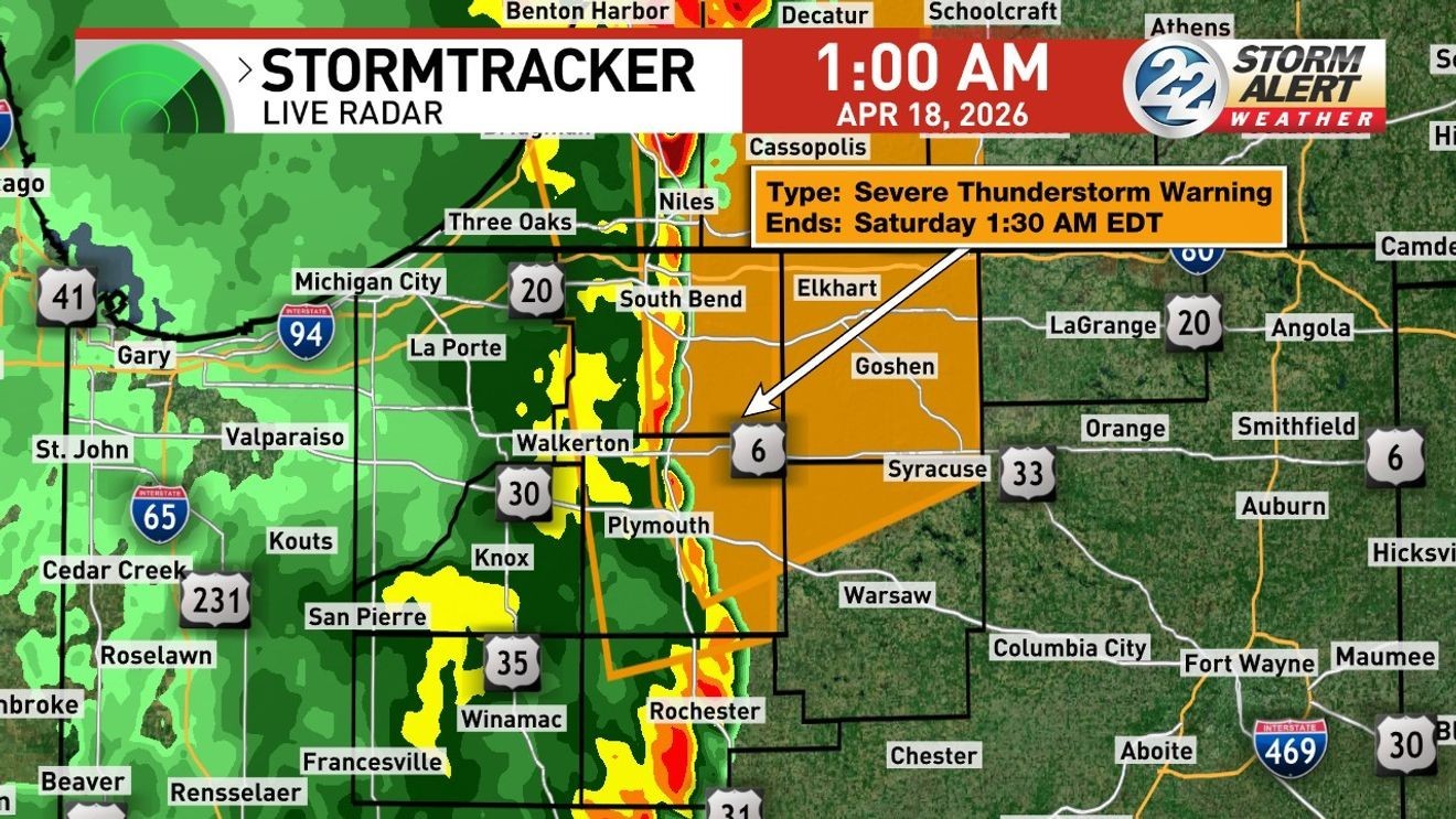
A Severe Thunderstorm Warning has been issued for parts of our viewing area.
The counties affected in indiana are St. Joseph, northwestern Fulton, Eastern Pulaski County, Starke County, Marshall County and LaPorte County. In Michigan counties affected are Cass and Berrien.
A tornado watch remains in effect until 3 a.m. Saturday.
Chances for severe weather return again on Friday night.
The severe chances come as a large cold front moves through the area.
Most of our area is under a Slight (level 2 out of 5) risk for severe weather, while our far eastern counties are under a Marginal (level 1 out of 5) risk for severe weather.
Most of our area is under a Slight (level 2 out of 5) risk for severe weather, while our far eastern counties are under a Marginal (level 1 out of 5) risk for severe weather. (WSBT22 photo)
The main risk for severe weather will be for damaging winds, however an isolated tornado and isolated damaging hail can’t be ruled out.

The main risk for severe weather will be for damaging winds, however an isolated tornado and isolated damaging hail can’t be ruled out. (WSBT22 photo)
Temperatures will be much cooler tomorrow with temperatures in the 40s and 50s.

Temperatures will be much cooler tomorrow with temperatures in the 40s and 50s. (WSBT22 photo)
BE THE FIRST TO COMMENT
Chances of rain during the day on Saturday are also low.