


Strong Tornadoes, Large Hail Possible
Severe weather is back yet again in the Plains the next few days and could become an outbreak by Sunday and Monday with tornadoes, hail and damaging winds from Texas to parts of the upper Midwest and Mississippi Valley.
While some details are still not clear this far in advance, here is our latest forecast for each day of this latest siege of severe weather.
(MORE: Severe Weather Safety Tips)
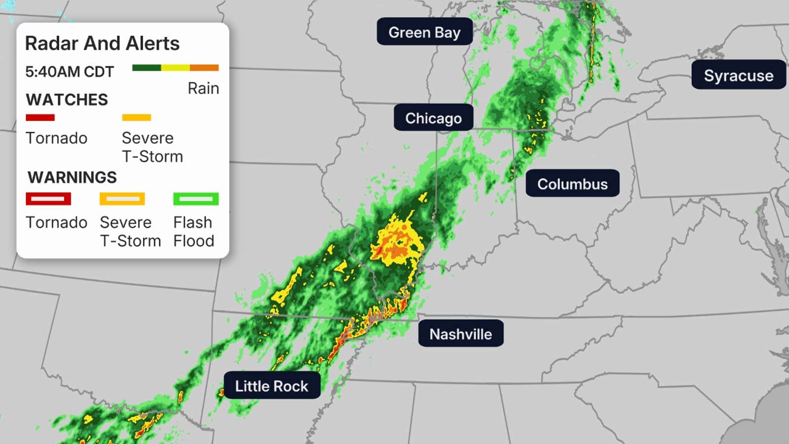
Happening Now
Severe storms are firing up across the Plains and will continue to increase along the cold front that is moving to the east across the region.
Latest watches from the Storm Prediction Center:
A tornado watch: valid until 7 p.m. CDT for western and central Iowa, northwest Missouri and eastern Nebraska. This watch includes Omaha.
A tornado watch: valid until 9 p.m. CDT for central and eastern Kansas. This watch includes Wichita.
A severe thunderstorm watch: valid until 8 p.m. CDT for western Wisconsin and eastern and southern Missouri. This watch inculdes Minneapolis.
Thursday
Severe storms are expected in the afternoon and evening from Minnesota to Oklahoma, possibly into parts of north Texas.
Tornadoes — a few possibly EF2 intensity — hail possibly larger than golf balls and damaging wind gusts are possible in these storms, particularly in the darker contours below.
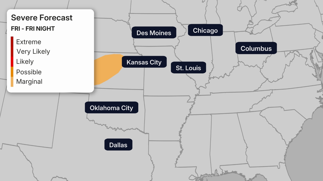
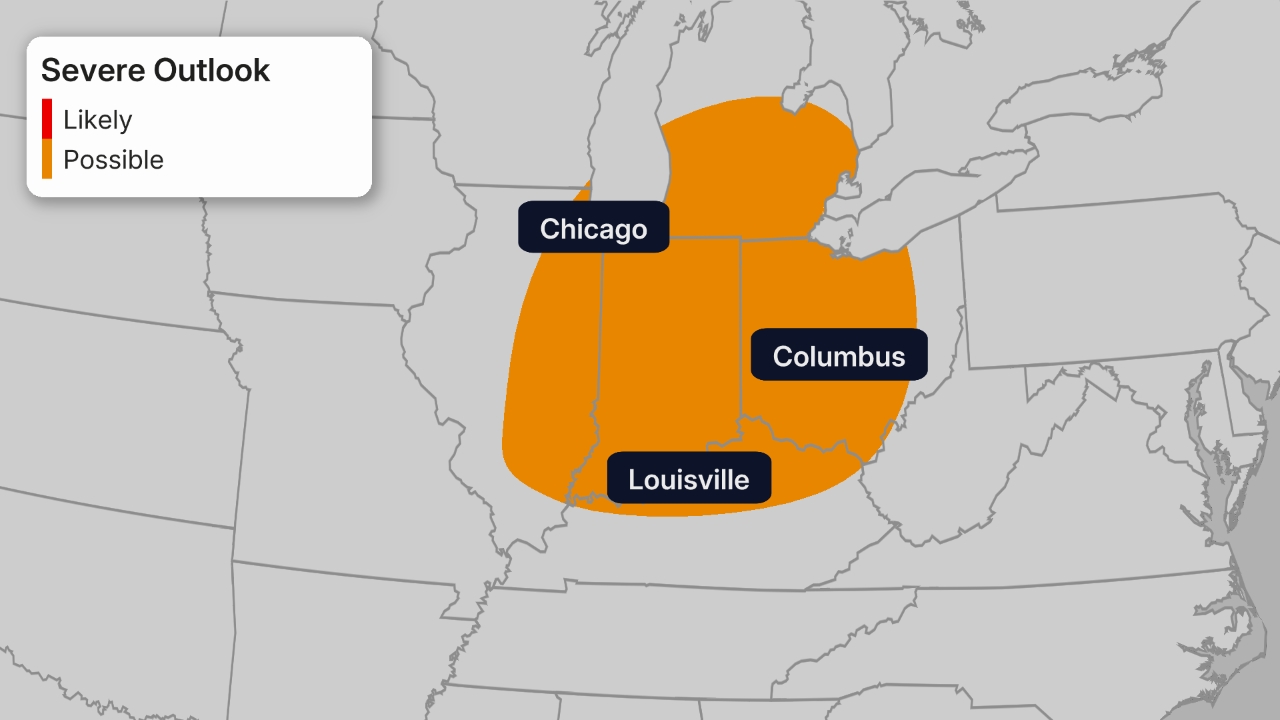
Friday
Scattered severe storms are possible from northeast Texas and eastern Oklahoma to the mid-South region, both in the morning and again in the afternoon. A few strong to severe storms are also possible in parts of Indiana and Ohio.
Damaging wind gusts and large hail are the main threats Friday in the areas shown below.
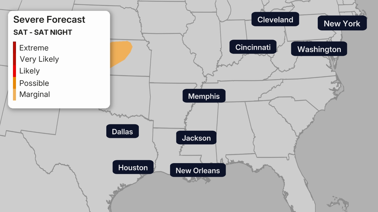
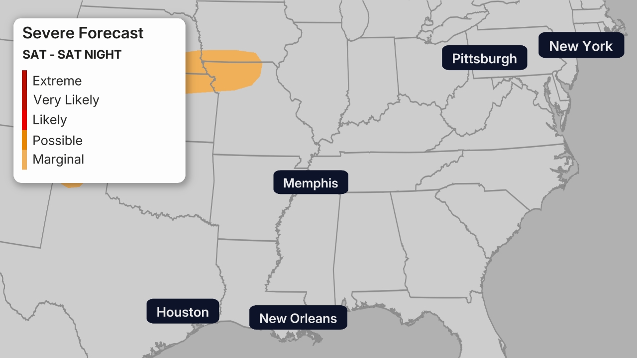
Saturday
The severe threat then steps up once again Saturday.
In the areas in the darker contours, we expected severe thunderstorms with large hail, damaging winds and a few tornadoes, especially in the evening.
Sunday – Monday
A potentially more serious severe weather threat looms starting Sunday.
Sunday, a threat of supercell thunderstorms is in play in the Central and Southern Plains from parts of Texas to Oklahoma, Kansas, western Missouri, western Arkansas and possibly parts of Nebraska.
With enough warm, humid air and strong wind shear in place, these supercells could spawn strong tornadoes, in addition to very large hail and damaging wind gusts.
On Monday, this higher severe threat could spread to the Mississippi Valley and lower Ohio Valley.
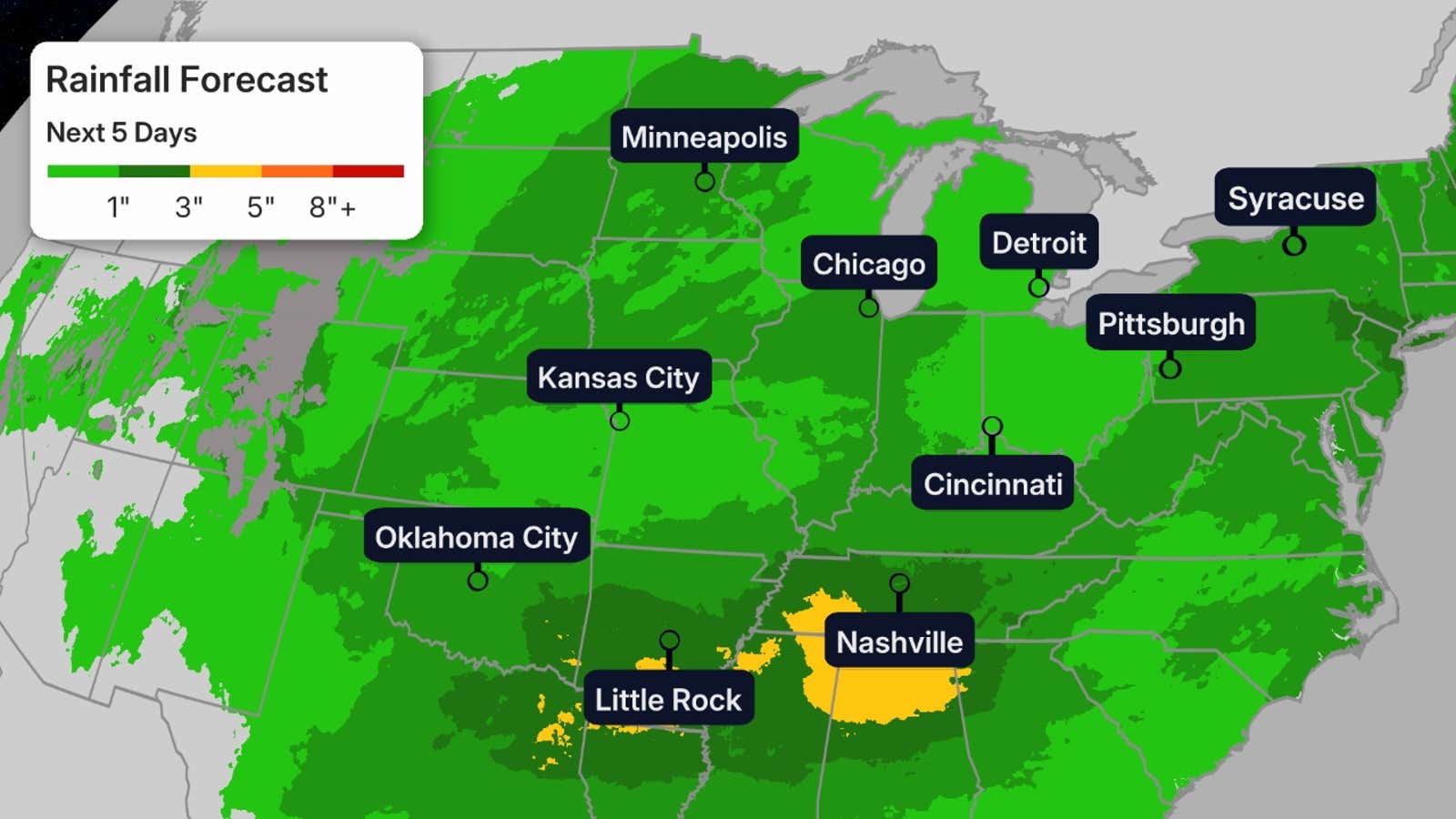
Flood Threat
This stormy pattern will bring more periods of rain to parts of the western Great Lakes either still experiencing flooding or where ground is already saturated from the deluges both last week and earlier this spring.
While we don’t anticipate the magnitude of rainfall we saw last week, over an inch of additional rain is a good bet in much of the Midwest through Monday. That could lead to at least isolated additional flash flooding and could slow the fall of rivers still in flood.
Locally flooding rain is also possible through Monday from parts of Missouri and Kansas into Arkansas and the mid-South region, even though some of these areas are in extreme drought.
Beware of flooded roads, especially at night when you may not recognize them as fast. Never attempt to drive through a flooded road. Turn around, instead.
(MORE: Flash Flood Safety Tips)
Last Week’s Siege
The early-week breather was certainly welcomed after a busy stretch last week.
Last Friday alone, there were 96 tornado reports among the over 500 severe weather reports.
(MORE: How April’s Severe Weather Has Been Weird)
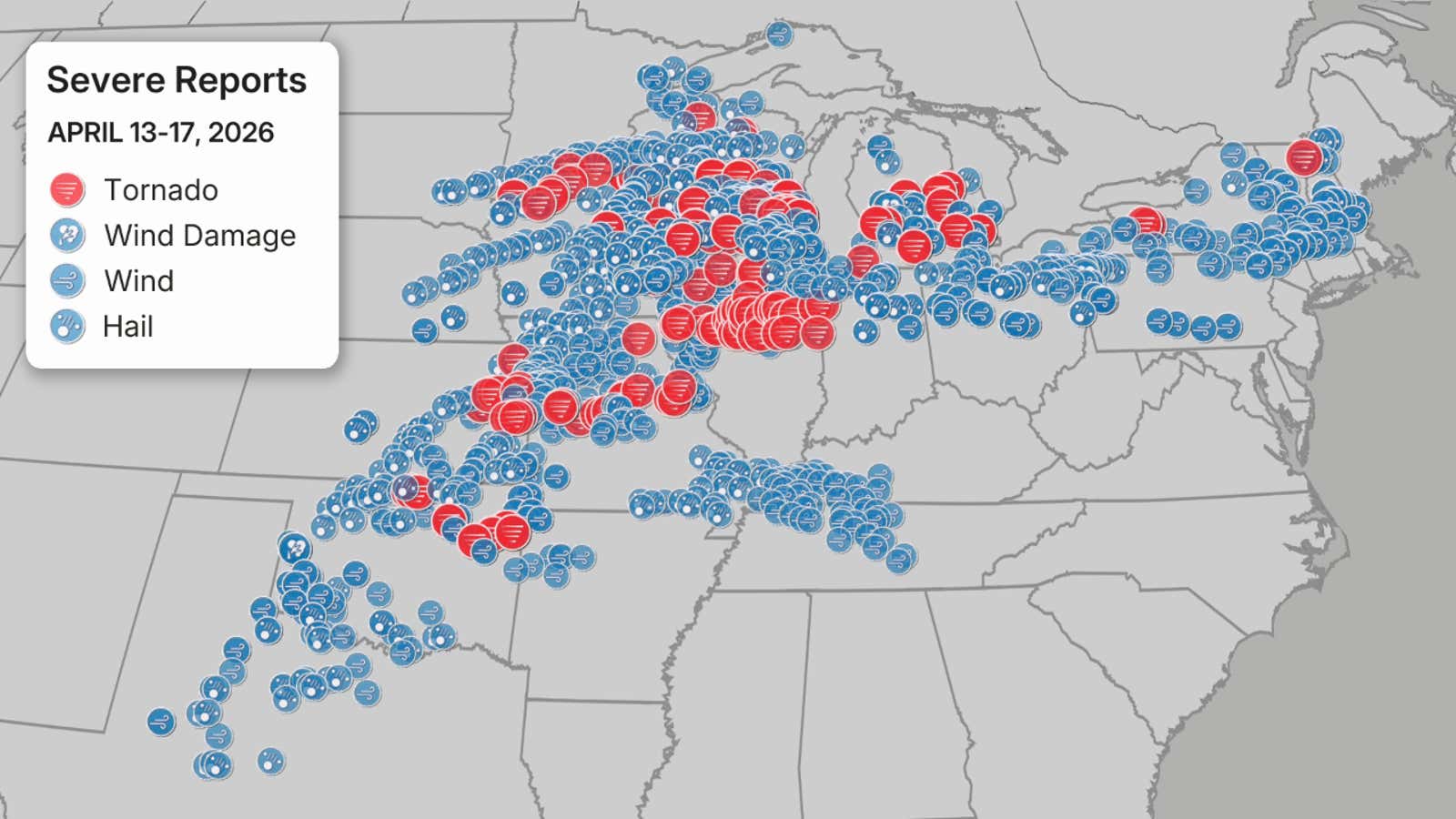
Reports of large hail, thunderstorm wind damage, thunderstorm wind gusts and tornadoes from April 13-17, 2026. Note: Reports of tornadoes do not necessarily correlate to the actual number of tornadoes, as determined by NWS damage surveys.
(Data: NOAA/NWS/SPC)
In all, there were over 1,300 reports of severe weather in the U.S. from last Monday through last Friday, including 154 reports of tornadoes, 532 reports of hail and 642 reports of thunderstorm wind damage or high wind gusts.
As you can see, some of the same areas that are under the risk of severe weather ahead are areas that have already been hit hard by severe weather last week.
Make sure you have multiple ways to receive alerts, should severe weather strike.
Jennifer Gray is a weather and climate writer for weather.com. She has been covering some of the world’s biggest weather and climate stories for the last two decades.


