The 9NEWS Weather Impact Team is tracking a late-April, early-May spring storm set to bring rain to Denver and heavy snow to Colorado’s mountains.
DENVER — A spring storm system is expected to sweep through Colorado on Thursday and Friday, bringing much-needed moisture to the Denver metro area and heavy snowfall to the mountains.
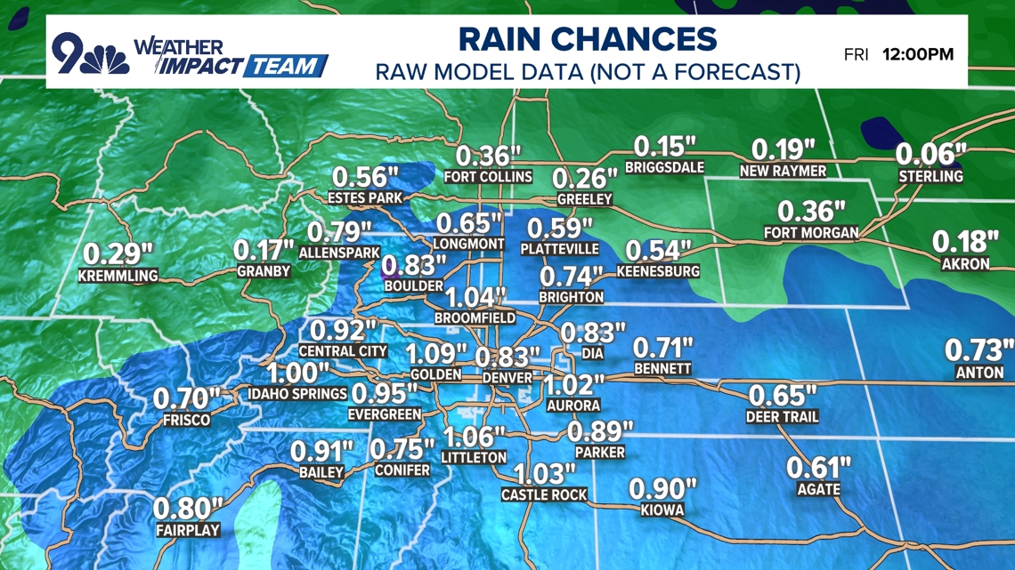
The 9NEWS Weather Impact Team is tracking the storm, set to arrive Thursday and continue into Friday, which could deliver 0.5 inches or more of rain to Denver — what would be the city’s largest rainfall total in over seven months.
Colorado mountain areas above 8,000 feet could see accumulations exceeding six inches of snow, primarily east of the Continental Divide.
Rain is expected to fall across the Denver metro area for most of Thursday. As colder air moves in Thursday night, precipitation will transition to snow along the Palmer Divide — including Douglas and Elbert counties — and in the foothills above 6,000 feet.
Higher-elevation communities such as Conifer, Evergreen, and Genesee face the strongest chances for several inches of slushy accumulation. Communities along the southern corridor, including Castle Rock, Larkspur, and Monument Hill, are also in the zone for meaningful snowfall Thursday night.
Denver itself could see some snowflakes by early Friday morning, though accumulation there remains uncertain and will depend on the storm’s ultimate intensity.
“I don’t care if it’s liquid, if it’s solid, we need the water,” said 9NEWS Weather Impact Team meteorologist Chris Bianchi. “We’re getting some on Thursday.”
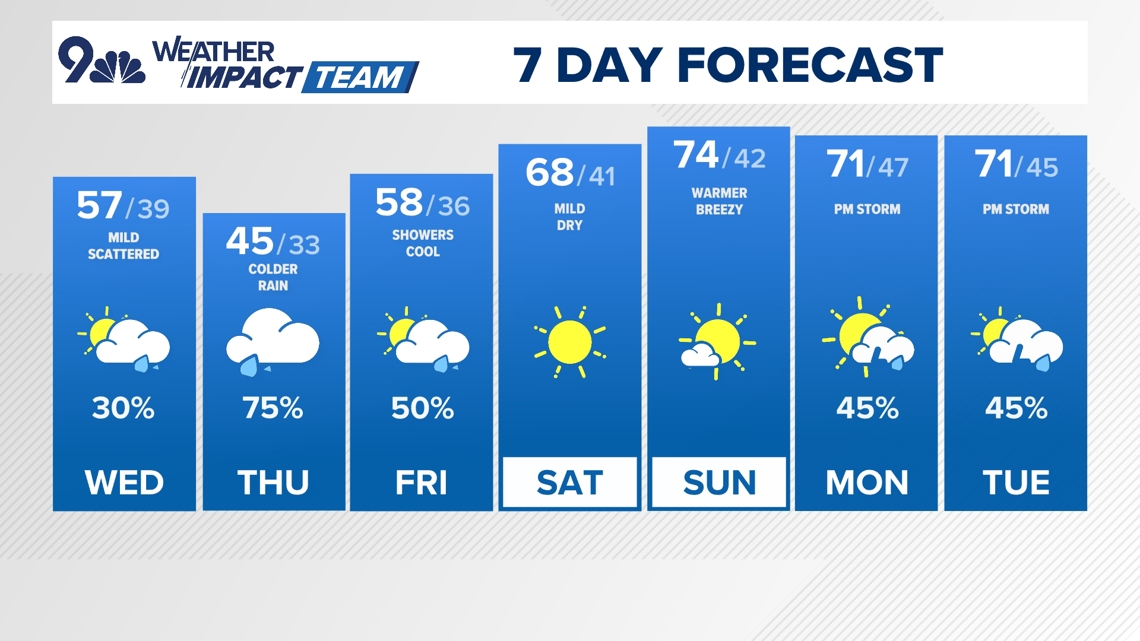
DENVER FORECAST
- WEDNESDAY: Party cloudy with a chance for showers. High 57, low 38.
- THURSDAY: Chilly and cloudy with rain likely. High 45, low 33.
- FRIDAY: Mostly cloudy with morning showers. High 58, low 36.
- SATURDAY: Mostly sunny and warmer. High 68, low 41.
- SUNDAY: Partly cloudy and warm. High 74, low 42.
- MONDAY: Partly cloudy and warmer with an afternoon shower. High 71, low 44.
- TUESDAY: PM storm chances. Mild. High 71, low 45.