LINCOLN, Neb. (KOLN) – Sunday and Monday will be days to watch very closely if you live in Nebraska. Multiple rounds of severe thunderstorms are expected, bringing the potential for large hail, damaging winds, tornadoes and flash flooding across the state.
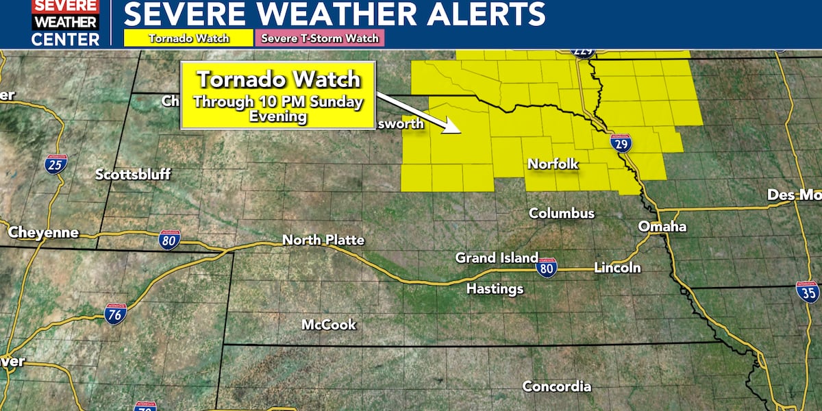
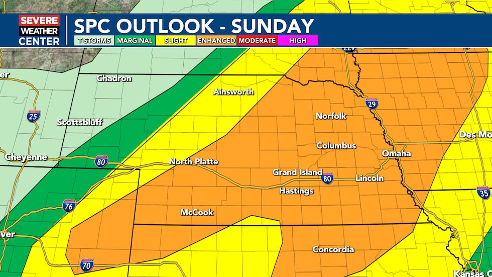
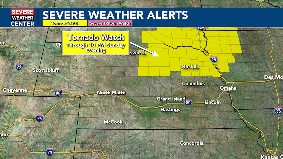
The Storm Prediction Center has an Enhanced Risk for severe weather Sunday afternoon and evening, with a Tornado Watch in effect for northeastern Nebraska through 10 p.m. Sunday. This is a significant threat with all severe hazards expected.
What to Expect Sunday Evening
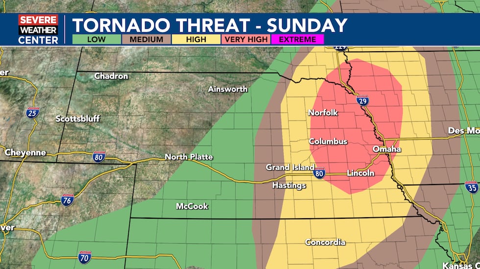
Tornadoes: A few tornadoes are likely this Sunday afternoon and evening, with a couple of intense tornadoes possible. The tornado threat will be highest across eastern Nebraska, where the atmosphere will be especially favorable for tornado development.
Hail: Scattered large hail is likely, with isolated very large hail events up to 3 inches in diameter possible — larger than a golf ball.
Wind: Scattered damaging winds are likely with wind gusts up to 85 mph possible. This is strong enough to cause significant damage to homes and trees.
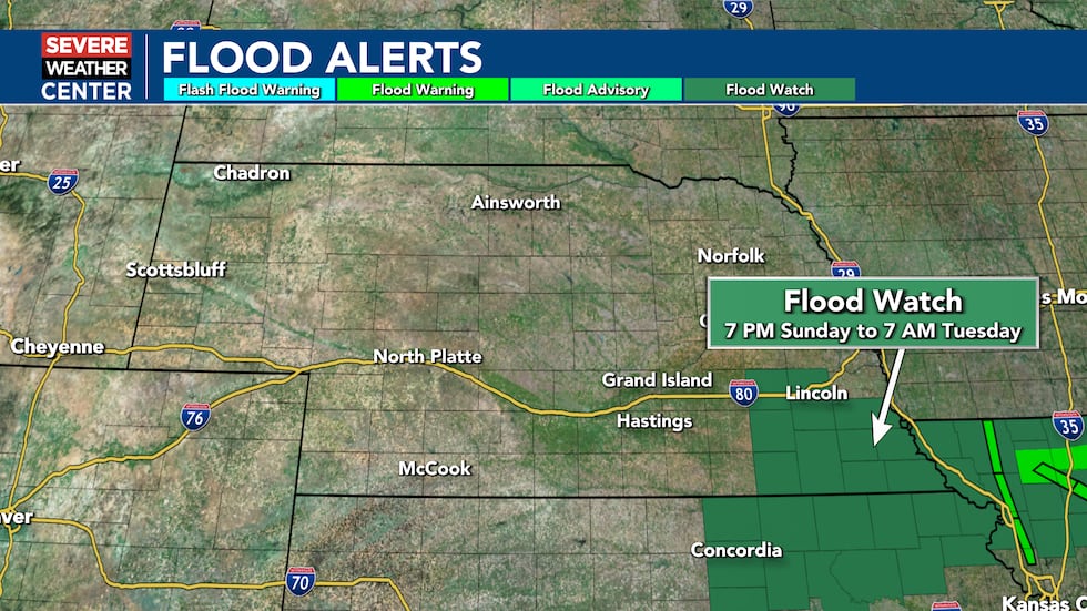
Flooding: Heavy rainfall is also expected. A Flood Watch is in place across southeastern Nebraska from 7 p.m. Sunday through 7 AM Tuesday. Flash flooding will be possible, particularly in areas that have already received a few inches of rain over the last 48 hours.
Timing for Your Area
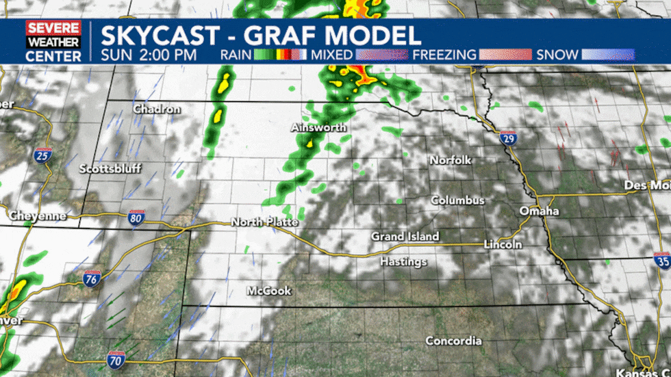
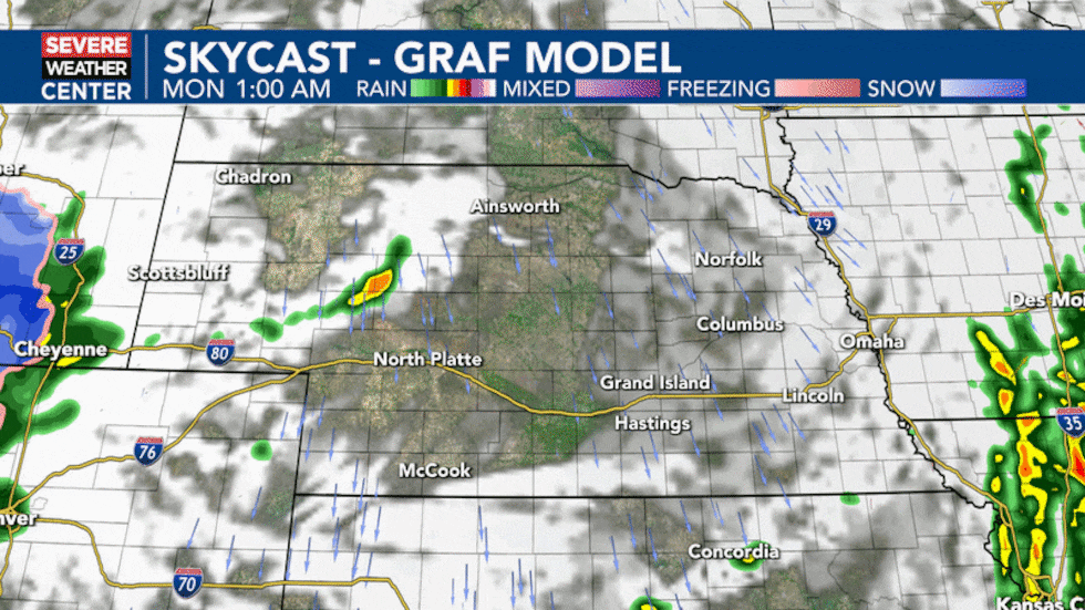
Storms are expected to develop around 5 p.m. in the Highway 281 corridor, becoming more likely by that time across the eastern half of the state. For Lincoln residents, the window of opportunity for storms will be from 6 p.m. to 10 p.m. this evening. Most of Nebraska should be storm-free by 8 to 9 p.m., though southern portions of the state have potential for a longer-duration event with storms continuing to build near and just north of I-70.
The entire area near and east of Highway 281 has some threat for tornadoes, although the highest risk is expected to be north and east of Grand Island.
Why This System Is So Dangerous
The atmosphere across Nebraska will have the perfect ingredients for severe thunderstorms Sunday evening. Warm, moist air combined with strong wind shear (winds changing speed and direction with height) will allow storms to rotate and produce tornadoes. The strongest storms will be capable of all hazards — tornadoes, large hail and damaging winds.
Monday’s Threat — Even More Dangerous
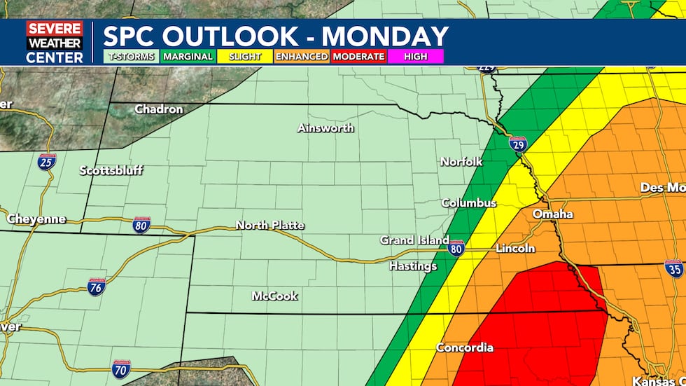
The Storm Prediction Center has issued a MODERATE RISK for severe weather Monday from central Kansas to southeast Nebraska — a step up from Sunday’s Enhanced Risk. This means numerous severe thunderstorms are expected to develop Monday along a cold front.
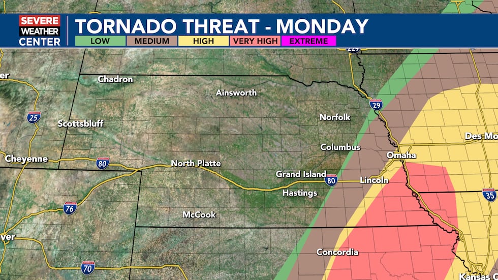
Supercells capable of very large hail and strong to intense tornadoes are most likely from central Kansas into southeast Nebraska. This is the area of greatest concern Monday.
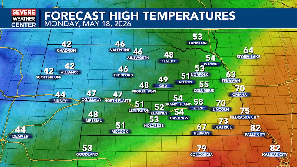
Portions of northern Kansas and the Highway 81 corridor in Nebraska could see severe storms in the 3 p.m. to 8 p.m. timeframe. The rest of Nebraska will be noticeably cooler Monday with only a few showers expected.
Monday will be even more unstable than Sunday. Very moist air will move in from the south, and when combined with daytime heating, it will create an extremely favorable environment for strong to intense tornadoes and very large hail. The strongest tornado threat will occur before storms merge together into larger lines, with severe wind gusts and embedded circulations becoming the main concerns into Monday night.
Looking Ahead
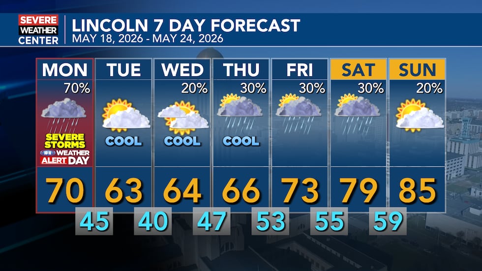
Cooler-than-normal conditions are expected through midweek. Tuesday and Wednesday will bring relief from the recent storms. Temperatures will gradually warm back up into Memorial Day Weekend.
Click here to subscribe to our 10/11 NOW daily digest and breaking news alerts delivered straight to your email inbox.
Copyright 2026 KOLN. All rights reserved.