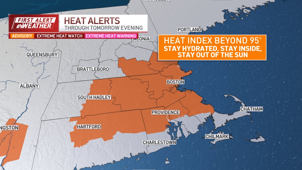
It’s a scorcher! Heat returned in full force today and tomorrow — heat indices, or feels-like temperatures, will be at and above 95 degrees this afternoon, prompting a heat advisory.
Strong storms began moving into New England as well, with severe thunderstorm warnings issued across Massachusetts (Worcester, Middlesex, Norfolk, Hampshire, Franklin, Hampden counties) as well as the Hartford, Connecticut, area in the afternoon. See all severe weather alerts in your area here, and track the storms with our live, interactive weather radar below.
Here are some helpful reminders as temperatures get close to 100 degrees: limit time in direct sunlight and spend time in the shade, wear light-colored clothing and hydrate when outside.
Today, Boston broke the record for May 19 of 90 degrees set back in 1949 — the thermometer said 96 as of noon — and tomorrow it may near or tie the day’s record of 91 degrees.


Both Tuesday and Wednesday feature the potential for afternoon thunderstorms. Downpours are possible for central Massachusetts to Boston before sunset, with an isolated severe thunderstorm possible, too.


Track the storms yourself with this interactive weather radar:
Expect cooler highs and lower humidity on Thursday and Friday before Memorial Day weekend, but we’re seeing rain chances increase for Memorial Day weekend. Stay with NBC10 Boston for updates on the holiday weekend forecast.