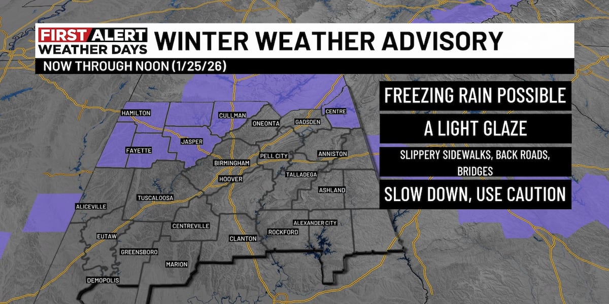
BIRMINGHAM, Ala. (WBRC) – Our First Alert Weather Day continues for some extreme cold across the area. At 10PM, our weather watcher in Hamilton reported 13 degrees. So, we will likely see some single digits in some areas Monday morning. A concern overnight will be residual moisture and black ice. Any puddles of standing water or areas of remaining runoff will freeze. Give yourself plenty of drive time and remain extra cautious on Monday morning, especially along elevated surfaces, bridges, and overpasses, or areas that may appear wet. The wind has helped evaporate lots of the moisture, but we especially could see some trouble spots where we had the wintry mix north.
Also, be careful on steps and sidewalks that may have residual moisture as that could freeze. We had some fog and even lingering mist/flurries north. You may notice a light glaze on the windshield, and your car door may be frozen shut, so give yourself some extra time Monday morning. County roads have been deemed impassable in Fayette, Marion, and Lamar counties. However, the state highways and interstate system remain open. We will have lots of traffic and weather updates on conditions beginning at 4AM on Good Day Alabama.
THE WEEK AHEAD: While the destructive ice storm remained all around our area, the frigid air will remain. We will stay below freezing through Tuesday morning. Temperatures will rise above freezing on Tuesday and Wednesday but expect more 20s at night. The forecast looks dry through midweek, with another surge of frigid air, sending overnight temps back into the 20s, with highs in the 30s on Thursday and Friday.
You can also track the latest weather alerts and advisories for any location on the free WBRC First Alert Weather app. Download it on Android and Apple devices.
Submit your weather photos, videos
Get news alerts in the Apple App Store and Google Play Store or subscribe to our email newsletter here.
Copyright 2026 WBRC. All rights reserved.
Source link
See more https://theglobaltrack.com/