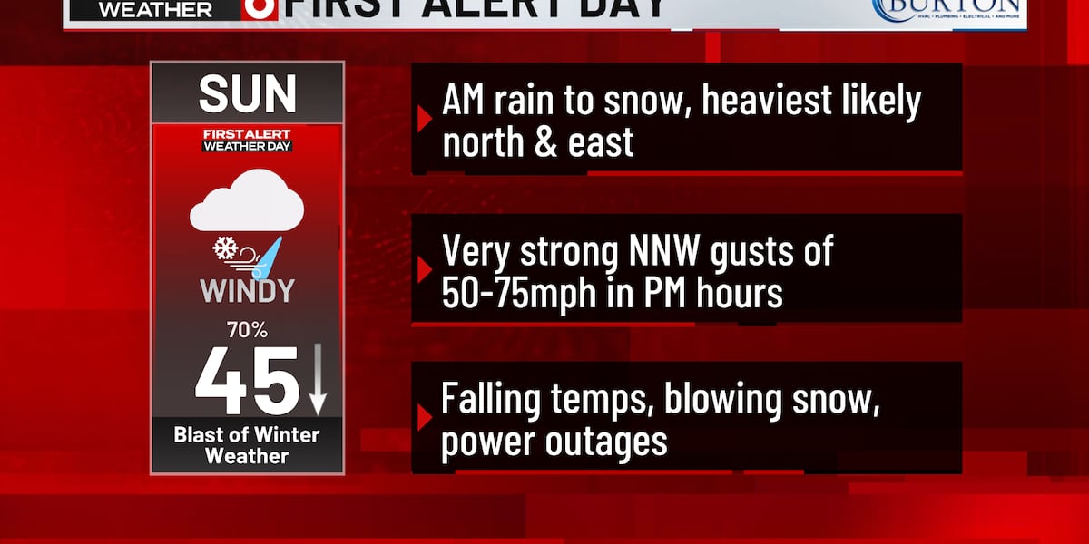
OMAHA, Neb. (WOWT) – Sunday is a First Alert 6 Weather Day as a storm system brings a round of rain and snow to our area, along with very strong wind gusts.
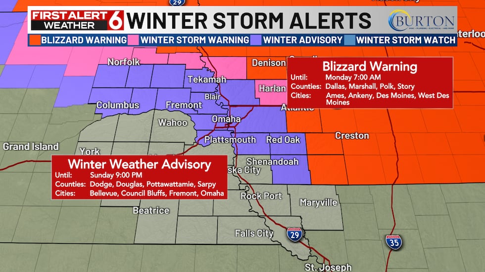
A Winter Weather Advisory has been issued for the metro and numerous counties until 9 PM Sunday. A Winter Storm Warning has been issued for Shelby and Monona County in Iowa until 9 PM Sunday as well. Blizzard Warnings have been issued for a few Iowa counties until 7 AM Monday.
Chances for precipitation will increase late Saturday overnight into Sunday morning. Rain is likely overnight with the change to snow not expected until mid morning.
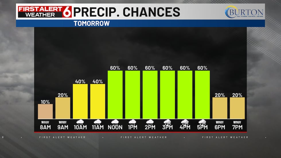
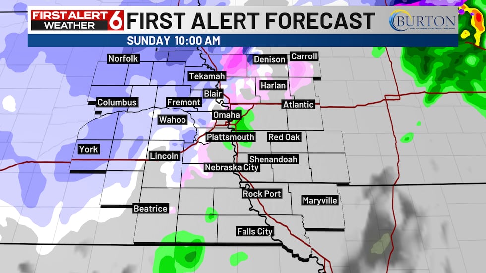
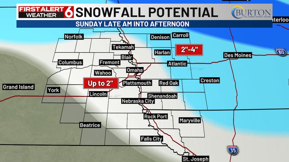
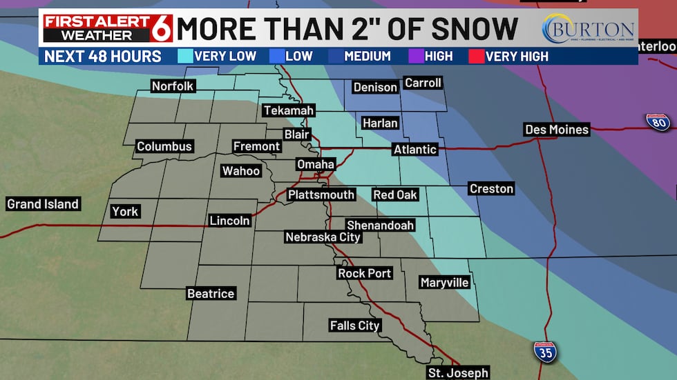
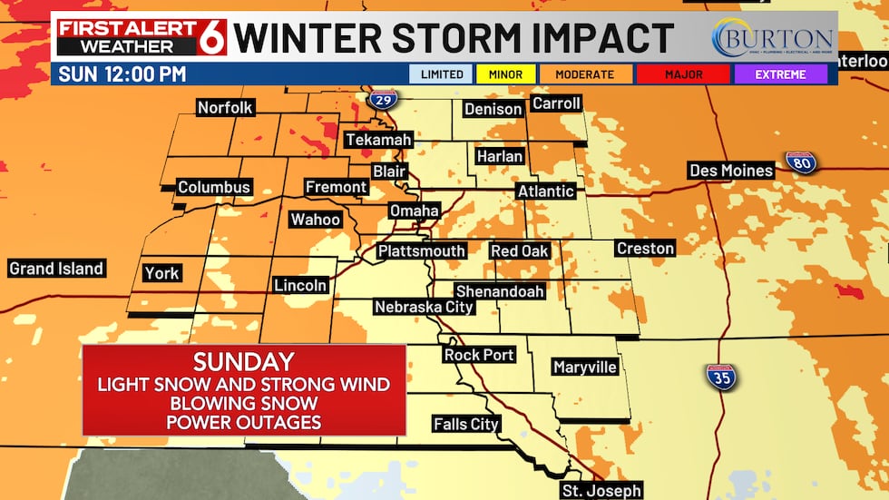
The snow could start as early as 10 AM on Sunday and continue through 6 PM. Once the snow begins, the winds will also drastically increase which will continue through the afternoon. 2″ or less of snow is likely in the metro and most of the area. Higher amounts are possible north and east of the metro.
Winds will pick up tomorrow with gusts between 50 and 75 mph possible out of the north and northwest. Models struggle to show anything more than 60-65 mph at this point but there are much stronger winds aloft that could make it to the surface and spike over 70 mph in the afternoon.
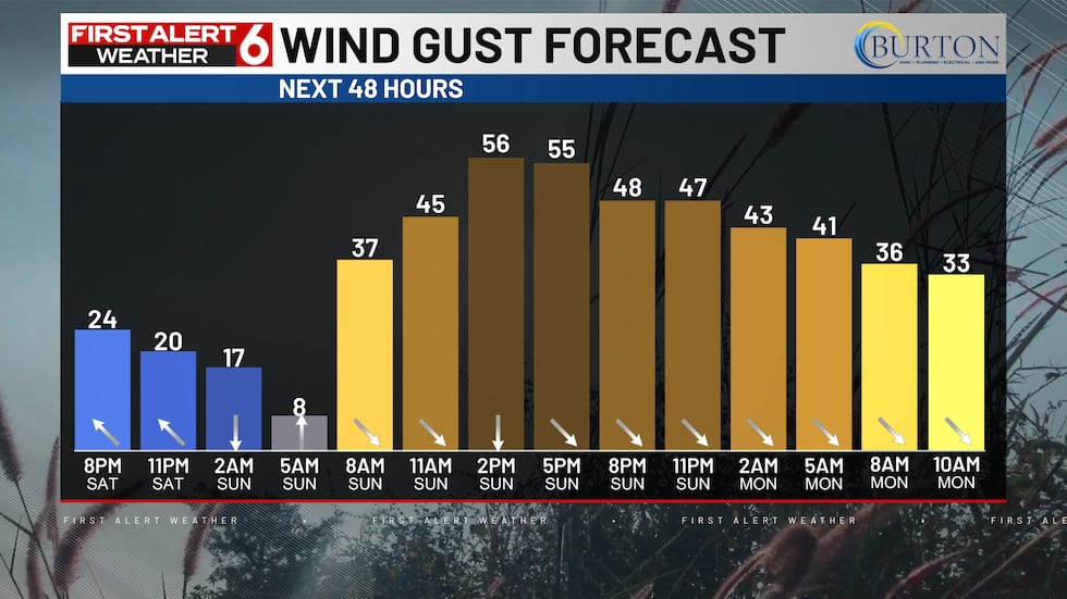
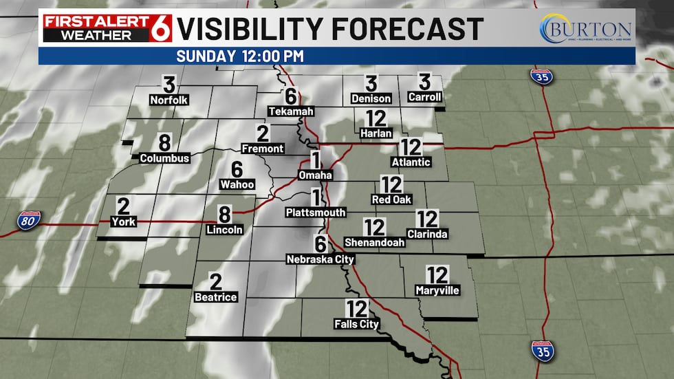
Even with light amounts of snow, this could impact travel through the day with visibility dropping in more open areas. Strong wind gusts may cause damage and potentially lead to power outages as these gusts are over the 60 mph threshold used for severe thunderstorm warnings.
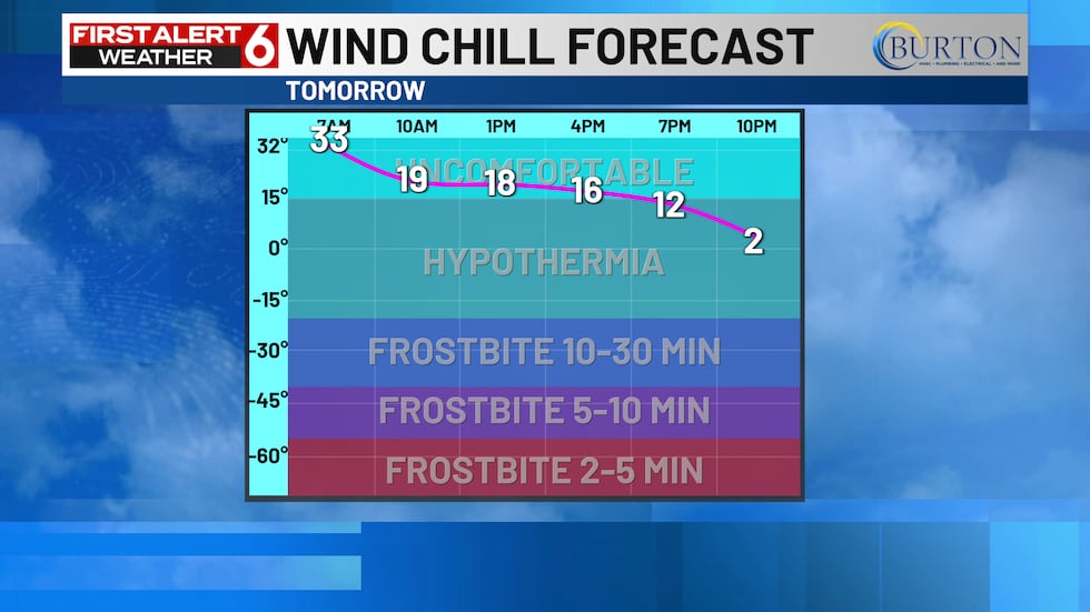
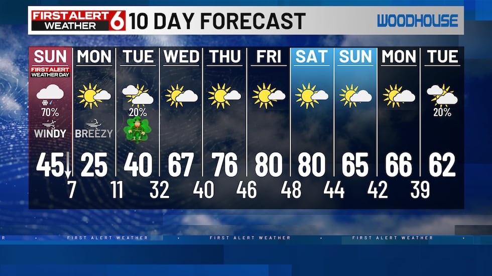
Temperatures will peak near the mid 40s in the morning before cooling through the rest of the day. As temperatures continue to drop, wind chills will drop into the teens and eventually the single digits with strong winds. Those wind chills should drop below zero by Monday morning.
The good news is the temperatures recover very quickly by Wednesday as highs reach back up into the 60s. It gets even warmer on Thursday and Friday in the 80s with plenty of sunshine for days.
Copyright 2025 WOWT. All rights reserved.