We have a windy Saturday as the gusts will be from the west between 20 and 40 mph. In higher elevations like the Worcester Hills and Berkshires the peak gusts push 50 mph and we have a Wind Advisory until 7 p.m. Cape Cod and the islands also have a wind advisory as some isolated damage or outages will be possible. The wind dies down after sunset, to scattered gusts and Sunday morning we start off calmer.
Sunday morning is the big St. Patrick’s Day parade in South Boston. The weather is quite seasonable for March! Highs in the 40s, mostly cloudy skies and staying dry for the duration of the parade and post parade celebrations.
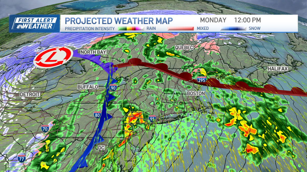
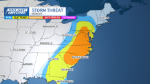
Monday is a First Alert day for impactful weather across New England. A powerful low pressure system moves across the country and will arrive in the northeast for Monday night. Prior to Monday, the severe weather risk is quite high across the middle of the U. S. for Sunday with numerous severe storms packing damaging wind, tornadoes, and hail.
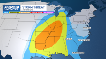
Then the severe risk shifts across the Mid-Atlantic for Monday. A very low chance for a severe storm will be around New England for Monday night as some storms could go severe in terms of damaging wind gusts. Aside from the storms, the south winds will be strong anyway ahead of the cold front. We pick up 1-2 inches of rain widespread through Tuesday morning.
Tuesday for St. Patrick’s Day the sky clears out and we stay breezy and cool with highs in the 40s. Next week remains pretty quiet with a colder day on Wednesday (30s) to the 40s through next weekend.