What to Know
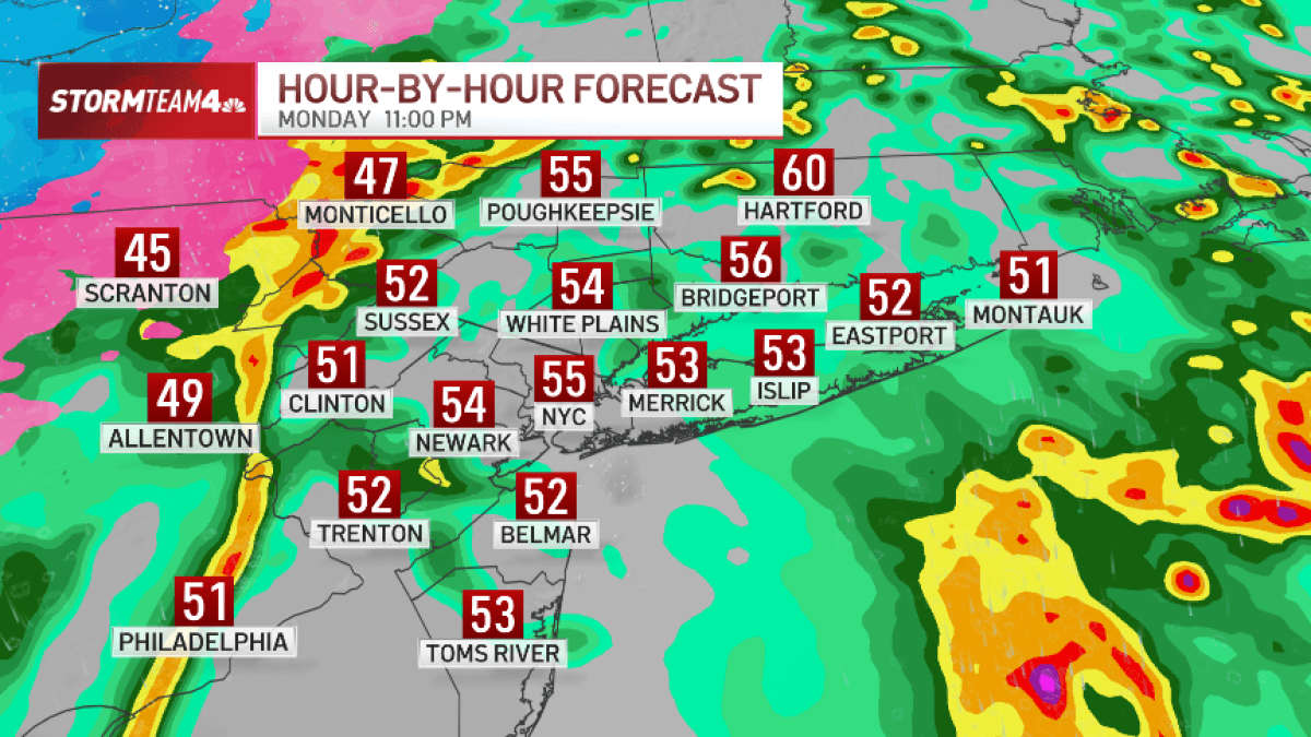
- Scattered showers continued through the afternoon but the main event wasn’t set to arrive until the evening commute or early evening.
- A line of storms pushed in around 6 p.m. ahead of a cold front, bringing with it the likelihood of severe level wind gusts of 50-60 mph.
- A wind advisory began at 2 p.m., and soon included the entire tri-state area
- Heavy rain and flooding is also a concern: Parts of NYC and into the Hudson Valley could get up to 2 inches of rain, while areas farther west will get up to an inch of rain. Some parts of Connecticut and a isolated spots of Long Island could get 2-3 inches of rain.
- The storms will move out by midnight or so. Colder air follows the front and we may even see some snowflakes early Tuesday morning — nothing that will stick, though.
A line of powerful storms bringing heavy rain and strong winds hit Monday for the tri-state, and lingered late into the night.
New Jersey was the most at-risk for severe weather, with a tornado watch having been in place for much of the state until 7 p.m. That watch was canceled at 6 p.m. Isolated severe thunderstorms are possible for the New York City area.
Follow along below for the latest updates on the storms: