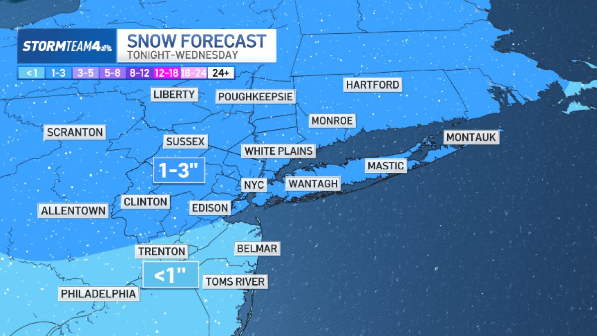
You know how this last storm started with predictions for 1 to 3 inches of snow and turned into one of the top 10 snowfalls in Central Park history? We’re looking at another 1 to 3 inches of snow Tuesday night.
Fortunately, the elements aren’t expected to align for a big one this time. But you never know.
A warm front on Wednesday brings some light snow and rain early. Snow totals are expected to remain on the lighter side, ranging from 1 to 3 inches across the Hudson Valley, New York, City, Long Island and the Connecticut coast, with the higher totals mainly inland. There could be morning commute impacts.
By noon, any linger precipitation should have moved on.
A stronger low nearby Thursday into Thursday night may bring more wintry precipitation, mainly light snow or a wintry mix inland. More to come on that system in the next day or so. Once we get past this stretch, it’s sunny and mild into the weekend, with considerable melting through Sunday.
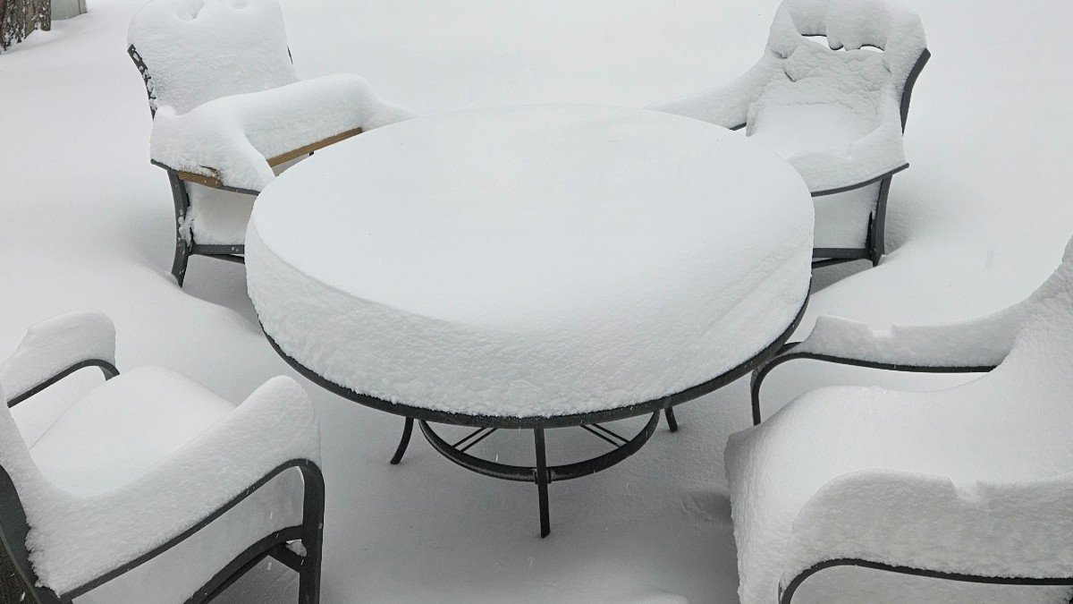
The record-breaking blizzard, the first one to hit the New York City area in a decade, brought the entire northeast of the United States to a halt on Monday. Now, everyone is left to dig out — and some even have to go to school.
Central Park recorded 19.7 inches of snow as of Monday afternoon, marking its ninth-biggest snowfall in recorded history.
The Long Island town of Islip, in Suffolk County, had the highest total seen across the tri-state, with 31 inches of snow. East Islip and Patchogue reported 30 inches as well. Holbrook and Babylon both got 29 or more inches. Parts of Staten Island also got more than 2 feet.

In New Jersey, two spots in Bergen County hit 30 inches: Lyndhurst, which got 30.7 inches, and Carlstadt, which got half an inch less than that. Leonia came close with 29.7, along with Bogota at 29.5. Newark Airport got 27.2 inches. See the full list of totals here.