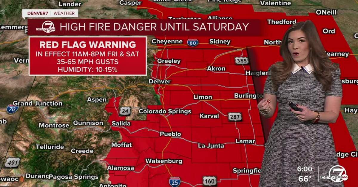
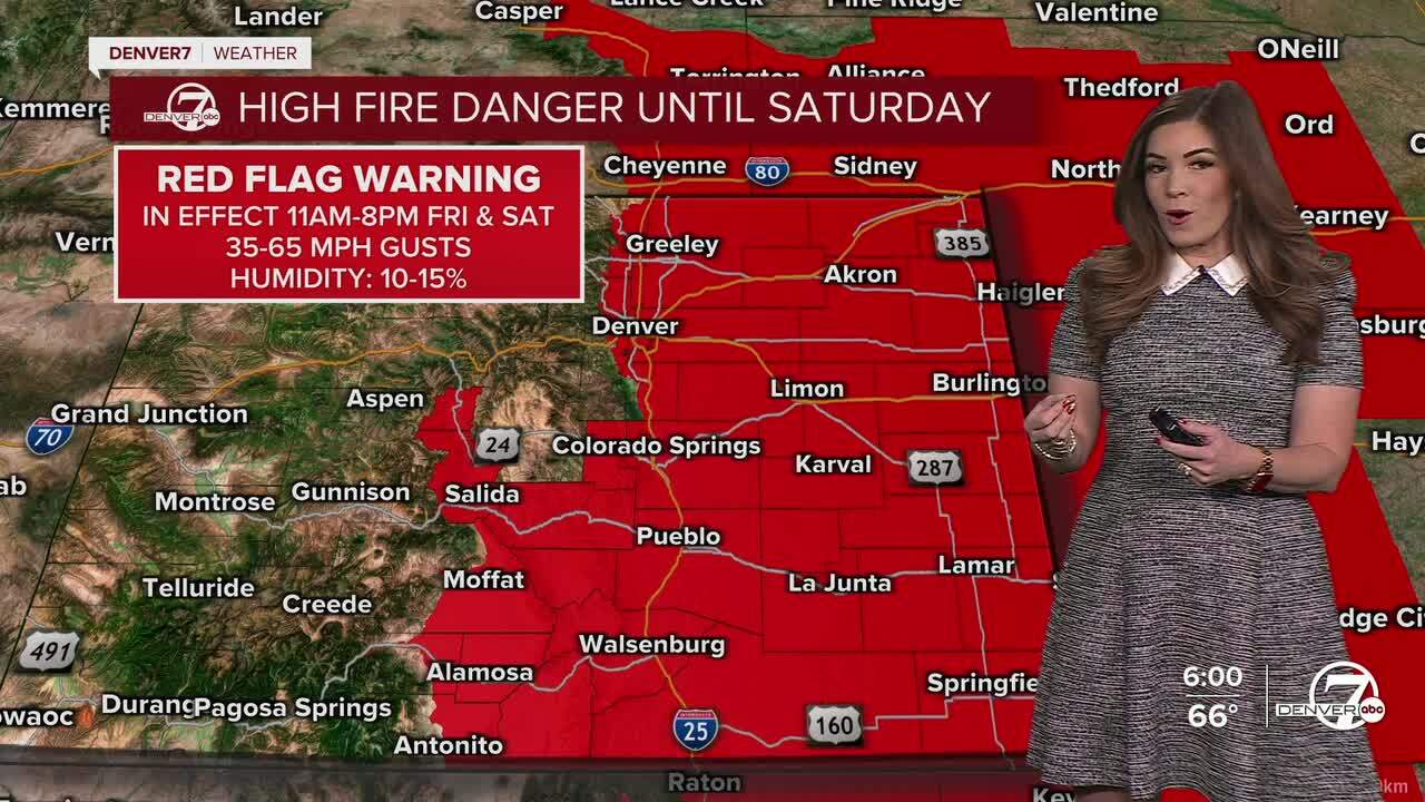
DENVER — We’re in for one more day of high fire danger along the Urban Corridor and Eastern Plains ahead of the state’s next big winter storm.
Denver7
Look for partly cloudy skies across the state along with very mild temperatures. Overnight lows will dip into the upper 30s to low 40s around the city.
The warm, dry and windy pattern continues Saturday and will likely be the most active day for fire weather. Daytime temperatures will reach the mid 70s on the plains, and winds will be even stronger than Friday with widespread gusts of 40 to 65 mph possible. The strongest wind will be west of Interstate 25. The combination of heat, dry air and blustery winds will keep critical fire weather conditions in place through the day. A Red Flag Warning continues from 11am to 8pm along I-25 and east to the Kansas state-line.
Denver7
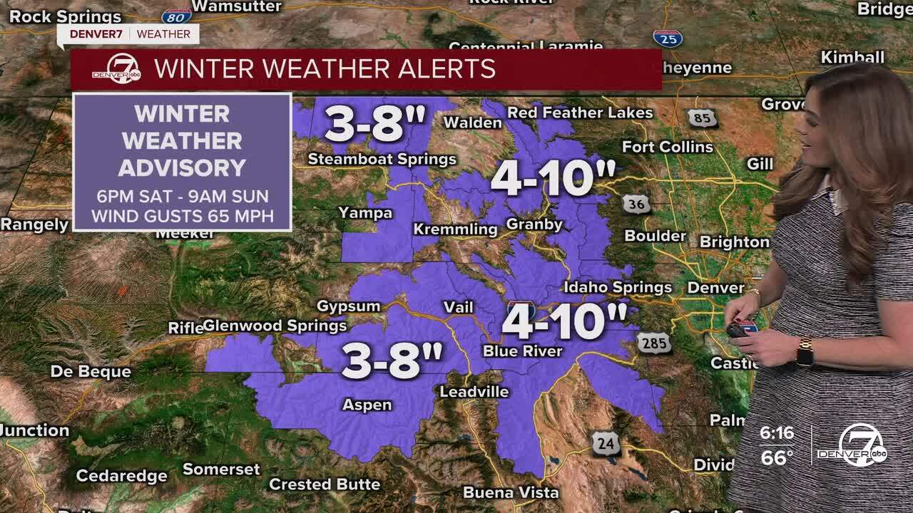
Weather whiplash moves in Saturday night as a strong cold front drops in from the north. Snow will begin developing in the mountains Saturday evening and continue overnight, with blowing snow and reduced visibility making travel difficult through Sunday morning.
If you’re heading into the high country late Saturday or early Sunday, be prepared for winter driving conditions. For the lower elevations, a quick round of light snow showers is possible overnight Saturday into early Sunday morning. Accumulations should stay fairly light for most areas, generally around an inch or less, though a few localized spots could see a bit more.
Denver7
Temperatures will drop quickly behind the front, as strong northerly winds gust up to 65 mph. This will make Sunday feel much colder with sub-freezing wind chills. A High Wind Watch is in effect for most areas east of Interstate 25 Saturday night into Sunday because of the expected blustery conditions.
After the weekend cool-down, a rapid warm-up begins Monday and continues through the rest of the week as high pressure builds over the western U.S.
Temperatures will climb back into the mid 70s Tuesday with Denver’s first 80-degree day of 2026 likely on Wednesday. This major heat wave will continue through the end of the week as highs could easily head into record-setting territory.
High fire danger Saturday in Denver; bitterly cold, snowy and blustery Sunday
DENVER WEATHER LINKS: Hourly forecast | Radars | Traffic | Weather Page | 24/7 Weather Stream
Click here to watch the Denver7 live weather stream.