QUAD CITIES, Iowa/Ill. (KWQC) —
***FIRST ALERT DAY WEDNESDAY & FRIDAY FOR STRONG STORMS***
Severe storms tonight
Break Thursday
Cooler weekend
***FIRST ALERT DAY in effect this afternoon and evening for strong to severe storms***
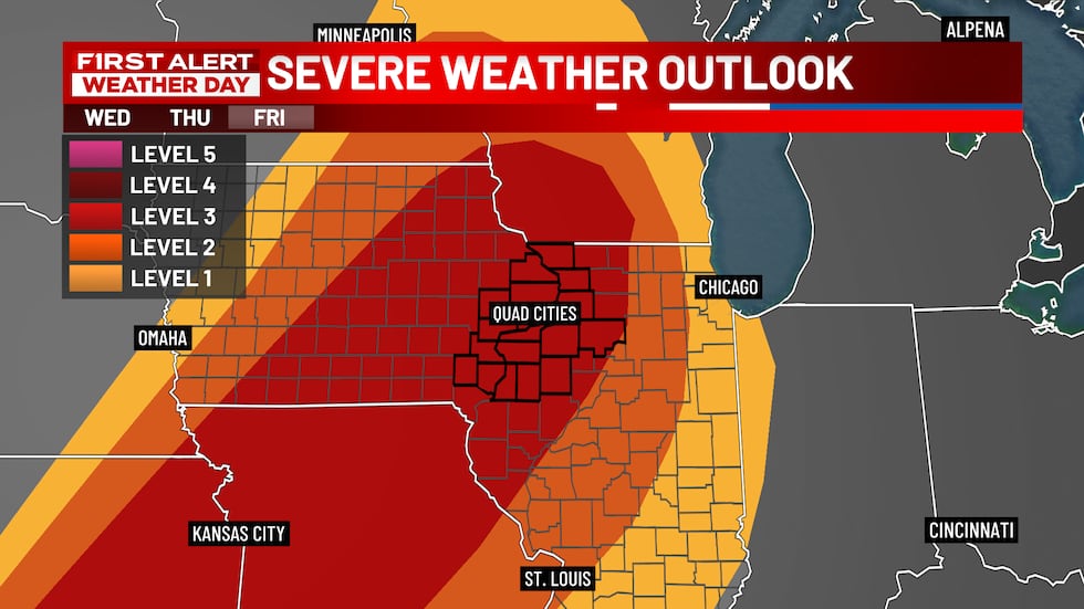
Our prolonged severe weather threat continues across the region this afternoon and evening as strong storms move across the region. The Storm Prediction Center has the entire TV6 viewing area at a Level 2 risk for severe storms. Damaging winds and large hail will be the primary threats, but it would not be out of the question to see a few tornadoes as well.
Look for several dry hours Thursday, with mostly sunny and warm conditions. Temperatures will remain above normal with highs in the 70’s to near 80 degrees.
After a brief break in the action, expect another round of strong to severe storms Friday. A FIRST ALERT DAY will be in effect through the afternoon and evening hours, with a Level 3 risk for the viewing area.
Temperatures will remain warm, reaching the upper 70’s to lower 80’s. Turning our attention to the weekend, it looks as though calmer and cooler weather will be the rule with sunshine and scattered clouds both Saturday and Sunday. Highs should reach the 50’s to near 60 degrees. Get ready for another warm up to start the work week.
TONIGHT: Mostly cloudy with showers and thunderstorms likely. Some storms could become severe. Low: 58°. Wind: SW 5-10 mph.
THURSDAY: Becoming mostly sunny and mild. High: 78°. Wind: W 5-10 mph.
THURSDAY NIGHT: Mostly clear and mild. Low: 57°.
FRIDAY: Mostly sunny and warm. Showers and thunderstorms by afternoon, some severe. High: 82°.
FIRST ALERT DAYS are issued to inform you of inconvenient, hazardous, or potentially dangerous weather in our viewing area–weather that could impact you and your family. Look for frequent updates on air, online, on our social media platforms and on the QC Weather App.
Copyright 2026 KWQC. All rights reserved.