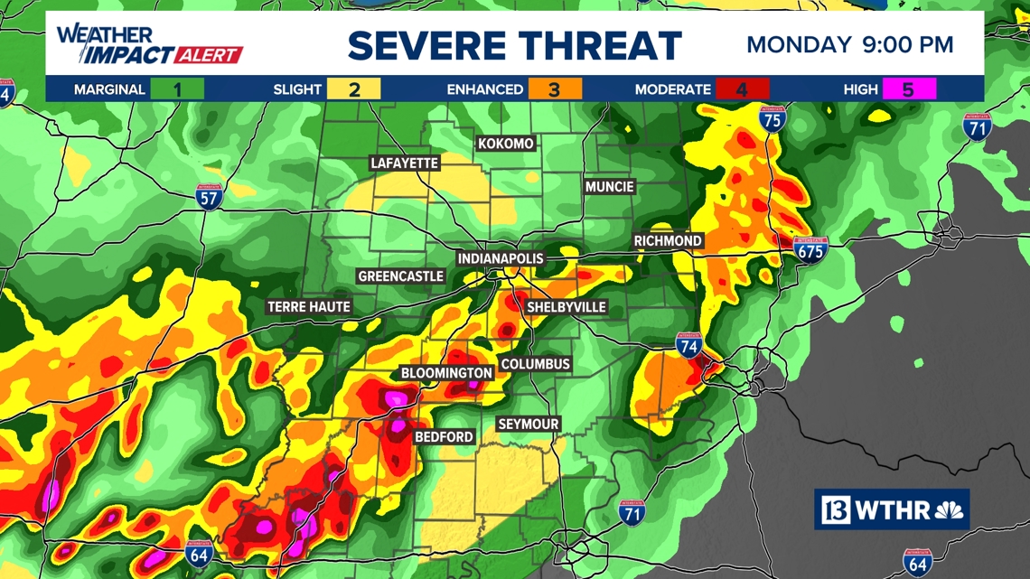
Additional heavy rain likely between now and midnight near and especially south of I-70.
INDIANAPOLIS — As expected, it was a wet and stormy afternoon in central Indiana, and we still have several more hours of moderate to heavy rain over the central and especially southern half of the state. Limited windshear and instability kept severe gust at minimum today, though we did have a few sporadic reports of tree damage.
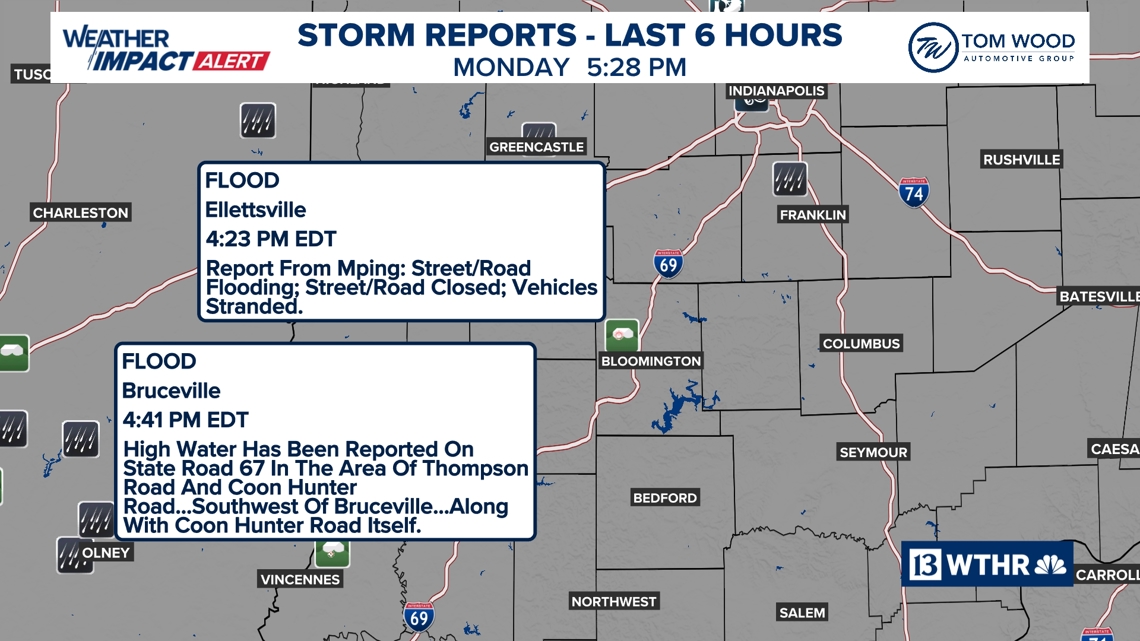


Many areas are under Flood Warnings and reports of flooding continue to come in from southwestern Indiana. Please use caution if traveling and avoid driving through water-covered roads.
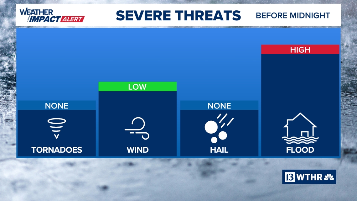
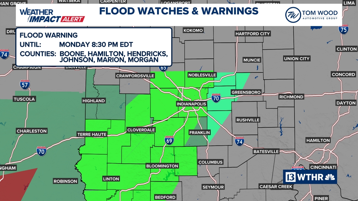
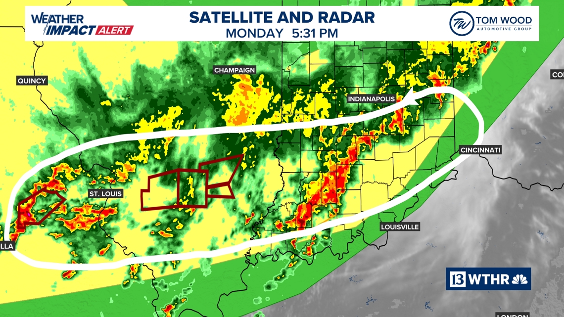
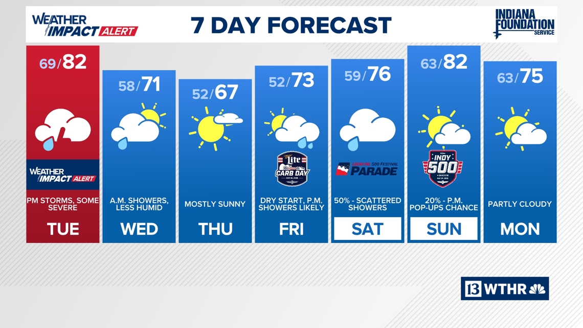
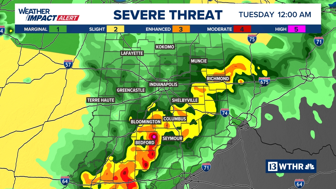
The axis of heavy storms has slowed south of I-70 and producing 1”-2”+ per hour rain rates. This will cause additional areas of flooding between now and midnight with some locations in south central Indiana likely exceeding 3″ of additional rain before midnight. Many areas are already under flood warnings and more of those are expected the atmosphere eventually settles down after midnight and then we will wait and watch to see how things unfold Tuesday.
Severe Storms Tuesday?
All of the state is under a Level 2 (out of 5) severe weather risk Tuesday, though there is a much greater uncertainty on how things evolve tomorrow. Some solutions keep us rather cloudy with limited heating which would intern limit the coverage and severity of storms in the afternoon and evening.
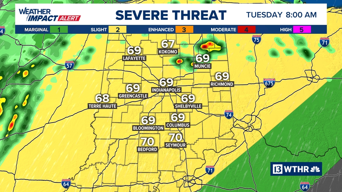
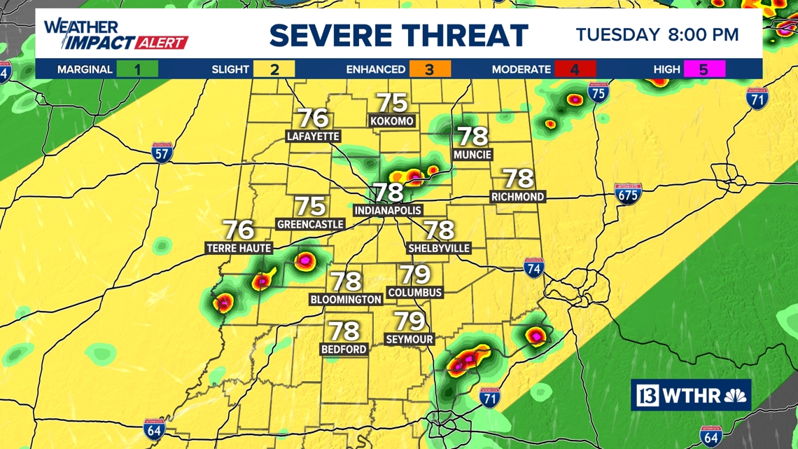
However, other high-res modeling is more bullish on storm development, and those storms becoming severe. The latter cannot be discounted. So we will continue with a Weather Impact Alert day for Tuesday, but with the caveat that it could be a “all or nothing” situation check back for updates in the morning.
Pleasant mid-week…rain returns Carb Day afternoon
The frontal boundary that’s putting the severe storms and play tomorrow eventually clears the state by midday Wednesday and allows for refreshing air to return Wednesday afternoon into Friday morning. Unfortunately, the “juicier” air begins returning Friday afternoon and brings an increased coverage of showers to finish Carb Day.
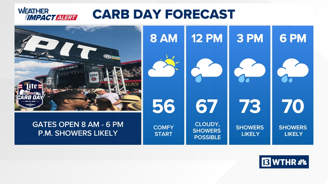
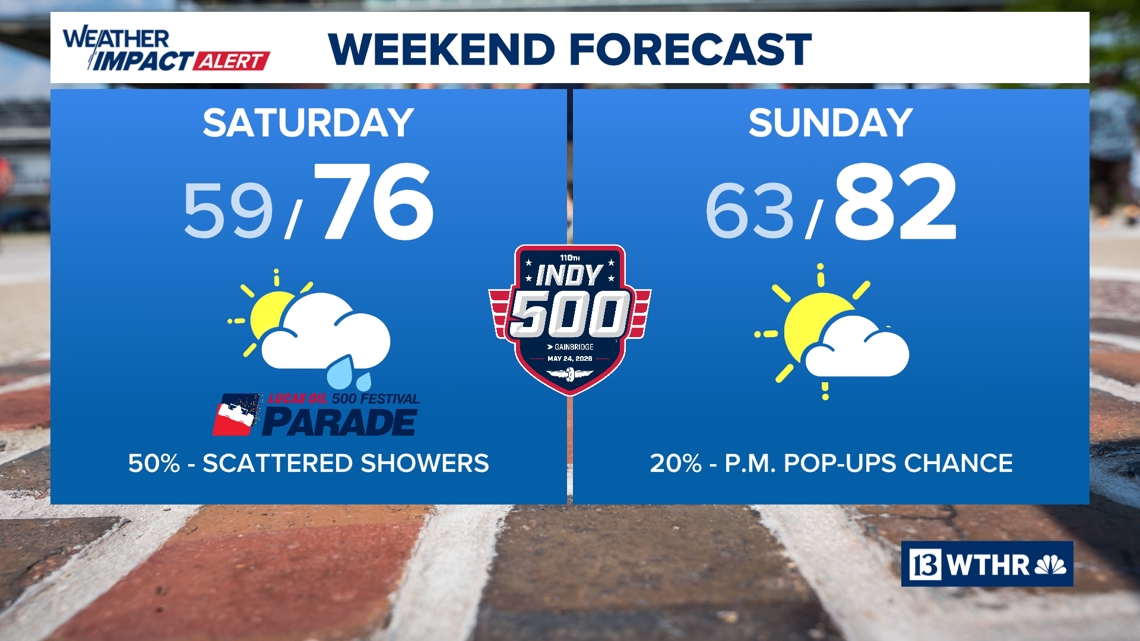
It’s subject to change this far out, but our current forecast is for a comfortable/dry start to Carb Day and a damp finish with showers becoming likely before the concert begins. Scattered showers will be around on Saturday though it’s too early to say if it will impact the 500 Festival Parade. The early call for the Indianapolis 500 is a 20% chance of pop-ups and highs nearing 80°. This is all subject to change and we will fine tune the details in the days ahead.