BRIDGEPORT, W.Va (WDTV) –
Unfortunately, winter is set to return in full force on Sunday. An area of low pressure will traverse the Southeast U.S. before intensifying as it tracks up along the East Coast. This feature, along with a weaker low over the Great Lakes, will begin to introduce snow to NCWV late Saturday night into Sunday morning, even as the coastal low pulls out to sea, northwest flow and lake effect/enhancement will allow snow activity to continue through much of Monday before winding down as we head into early Tuesday morning.
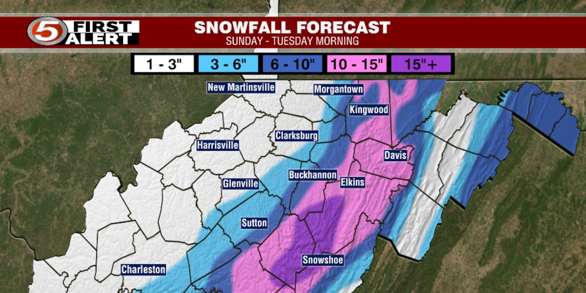
As is typical with this type of event, orographic enhancement—also known as the upslope effect—will result in our eastern high elevations seeing the heaviest snowfall totals. Sunday night through Monday, wind gusts of 30 to 40 mph are expected across much of our high elevations, making for near blizzard-like conditions when paired with the moderate to heavy snowfall rates. Come Tuesday morning, snowfall totals will vary greatly across NCWV from as little as 1 to 2 inches in some of our western and central lower elevation locations to potentially around 20 inches in the high elevations of Randolph, Webster, and Pocahontas counties. Below is my snowfall forecast map for this event.
Copyright 2026 WDTV. All rights reserved.