MONTANA — Snow tapered off in southern Montana this morning while minor snow squalls affected the Red Lodge to Billings areas into the afternoon.
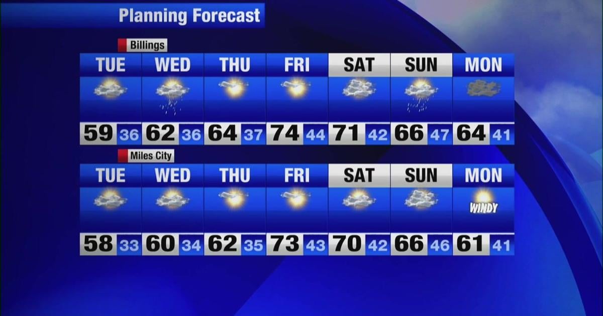
No active watches, warnings or advisories are in place this evening. Tonight, mostly dry conditions will continue into Tuesday morning. By the afternoon, isolated showers are possible statewide as a low-pressure trough moves in.
Wednesday will turn drier. Thursday should bring the best chance for dry and sunny weather as high pressure clears conditions and a warm front moves into the state.
Lows tonight will drop into the 20s across most of Montana tonight. Western valleys will stay in the 30s.
Highs tomorrow are forecast to climb back into the 50s for most major areas. That will put temperatures close to seasonal averages.
By the end of the week, highs will bounce back into the 70s in much of the region. Dry conditions through the second half of the week will last into Saturday. Rain will have a chance to return Sunday.
Our 8 to 14-day outlook will favor warmer-than-average weather in western Montana and near-normal temperatures in eastern Montana. Precipitation during that same period will trend near average statewide.