


4 things to know about the weather:
- Weather Alert: Strong PM storms
- 30° cooler Thursday
- Rainy through the weekend
- Still stormy on Monday
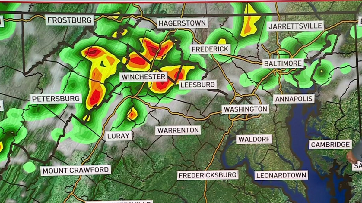
Storms are rolling through parts of Frederick, Maryland, and Loudoun, Prince William and Fauquier counties in Virginia. Severe thunderstorm warnings were issued for those aras, and much of the DMV is under a severe thunderstorm watch. Here’s a full list of weather alerts.
Dulles and Reagan National both reached 97° on Tuesday to set new record highs for the date.
Wednesday is just about as hot. The only difference is that Tuesday’s lone storm or two will be replaced by more widespread storm coverage Wednesday.
Storms firing up in the I-81 corridor will move into the D.C. metro area. The evening commute will likely be slowed quite a bit when the storm arrives.
With shower weather lasting through the night, temperatures will gradually fall to near 60° by Thursday morning. Temperatures will not budge more than a few degrees after that.
Download the NBC Washington app on iOS and Android to check the weather radar on the go.
Cooler, rainy weekend
Low 60s is about all we can hope for Thursday, Friday and Saturday. Thick clouds, frequent showers and a steady east wind are likely all three days. By Sunday and Monday, rain chances will drop from frequent to intermittent. That will hopefully allow for at least a few breaks of sunshine and a bit milder conditions.
Temperatures should get back near 70° on Sunday and 75° on Monday. With rain chances in the forecast every day for the next week, the big question is: “How much rain will we get?” Overall, at least 1.5 to 2.0 inches looks like a good estimate.
Wednesday’s thunderstorms could leave much higher amounts locally and with any luck, we will get some steadier areas of rain a few times on Friday and Saturday. If that happens, rain totals could easily climb into the 2-3 inches range for most with isolated totals of up to 5 inches spread over a 5-6 day period.
This event will be good news for our short term drought, but we would likely need another event similar to this to alleviate the longterm drought.
QuickCast
WEDNESDAY:
Very Hot, A Bit More Humid
Storms Likely After 3PM
Severe Storms Possible
Wind: Southwest/West 10-18 mph
Chance of Rain: 60%
HIGHS: 90° to 96°
WEDNESDAY NIGHT:
Clouds And Rain
Rainfall Around 1/4”
Areas Of Fog Likely
Wind: North 5-10 mph
Chance Of Rain: 100%
LOWS: 56° to 64°
THURSDAY:
Cloudy, Frequent Showers
Near Steady Temperatures
Rainfall Around 1/4”
Wind: Northeast 8-18 mph
Chance of Rain: 90%
HIGHS: 56° to 64°
FRIDAY:
Cloudy And Cool
Rain, Showers Likely All Day
Rainfall Around 1/2”
Wind: East 10-18 mph
Chance of Rain: 90%
HIGHS: 55° to 62°
SATURDAY:
Cloudy And Cool
Showery All Day
Rainfall Around 1/2”
Wind: East 5-15 mph
Chance of Rain: 90%
HIGHS: 58° to 64°
Sunrise: 5:52 Sunset: 8:18
Average High: 77° Average Low: 59°
Stay with Storm Team4 for the latest forecast. Download the NBC Washington app on iOS and Android to get severe weather alerts on your phone.
Source link
See more: https://theglobaltrack.com/
https://corinthiames.com.br/


