HOUSTON – Southeast Texas stays warm, humid, and breezy through Saturday afternoon with highs in the 80s and south winds around 10–20 mph.
Showers and storms will gradually increase throughout the day on Saturday, with the worst of the heavy rain late Saturday night through early Sunday morning.
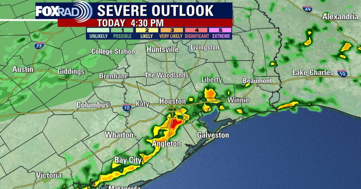
There’s a risk of heavy downpours that could lead to a few flooded streets and some strong storms.
Houston weather: April 18 morning forecast
Southeast Texas stays warm and humid through the afternoon, but showers and storms will increase throughout the day. Heavy rain moves in Saturday night through early Sunday morning. Fox 26 meteorologist Allison Gargaro has the details.
Heavy rain late Saturday into Sunday

A cold front moves in this weekend, bringing increasing rain chances Saturday with the highest likelihood for more widespread storms Saturday night into early Sunday.
Periods of heavy rainfall exceeding 2–3″ will lead to a risk of minor flooding especially after midnight Saturday into the very early morning hours Sunday.
Model trends continue to support the heaviest rain occurring overnight and ending by 7am Sunday.
Cooler, cloudy pattern follows

Behind the front, temperatures drop into the 70s with more clouds and a noticeable decrease in humidity.
Unsettled weather continues into early next week. This pattern keeps skies mostly cloudy & temperatures below normal through Tuesday.
Some warming returns later next week.
7-Day forecast

The Source: Information in this article comes from FOX 26 meteorologist Allison Gargaro.