It was hot Saturday with temperatures in the low 90s with partly sunny skies.
This evening we see showers and thunderstorms for our inland areas. This storms should come to an end by 10pm, but we could see a few storms near the coast overnight.
Sunday will start out much like Saturday, though morning temperatures will be a bit warmer and humidity levels will continue to rise. Most areas should stay dry through the first half of the day, with only a stray shower possible before noon.

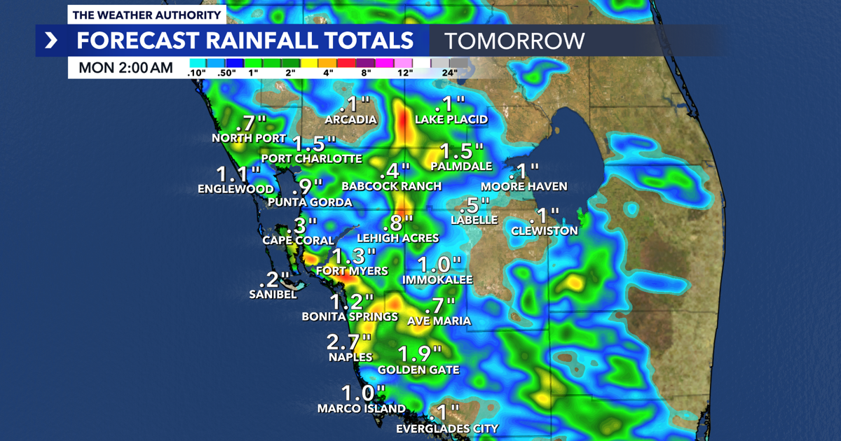
Tropical moisture moving in overnight and through Sunday will increase storm coverage during the afternoon and evening hours, with coastal communities likely seeing more widespread rainfall. Expect a typical summer weather pattern, with storms developing inland and pushing east to west later in the day.
If you have outdoor plans, the best window will be during the morning and early afternoon. Keep an umbrella nearby for anything later in the day, as rain chances increase by late afternoon and early evening. Highs will remain well above average, reaching the mid-90s.
Rain chances stay elevated to start the work week before tapering back to around 30% coverage later in the week. Temperatures will remain a few degrees above average each day, with highs consistently in the 90s.