CEDAR RAPIDS, Iowa (KCRG) – A line of storms accompanies a cold front, potentially bringing damaging winds.
(KCRG)
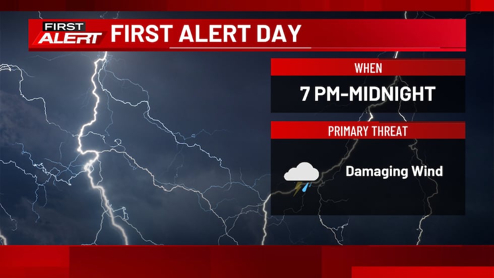
It’s a First Alert Day around eastern Iowa for that threat. We can’t fully rule out a report of hail in storms or an isolated tornado within the line of storms, but those look like secondary threats at this time.
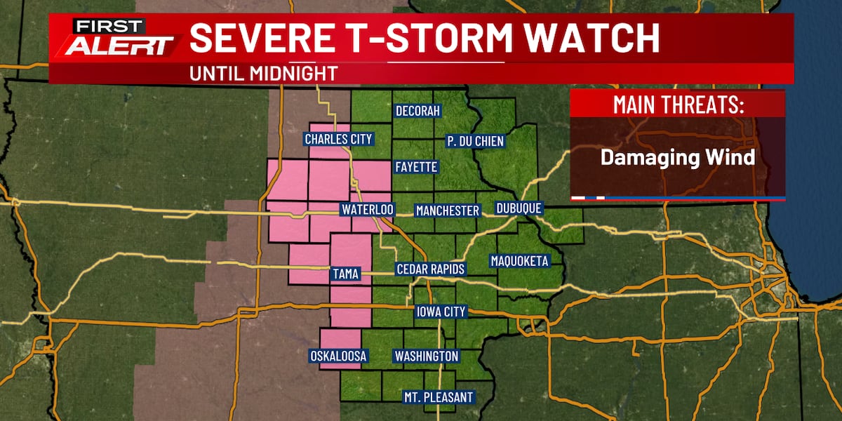
A line of storms with the threat of damaging winds and an isolated embedded tornado is on the way. They’re moving eastward at about 30 to 45 mph.

(KCRG)
That main line of activity will approach the middle of the TV9 viewing area from north to south by about 8:00 to 9:00 p.m, including areas like Cedar Rapids and Iowa City. For the eastern part of the viewing area, we’re talking more toward 10:00 to 11:00 p.m. for the main line of storms to arrive.

(KCRG)
The storms will be at their strongest as they move through our western communities. The risk for severe weather will gradually diminish as we get later in the evening, with the risk looking fairly low closer to the Mississippi River. As noted above, damaging winds will be the main threat with storms as they approach.
If a storm approaches your area, seek shelter indoors. If a warning is issued, get to the lowest floor of your home, away from windows. In the event of a tornado warning, put as many walls between you and the outside as possible, like in an interior closet or bathroom. A basement is best if you have one. Cover your head and neck with pillows or blankets, or a bike helmet if you have one. If you’re in a mobile home, abandon it for more substantial shelter. If caught outdoors, try to get to an indoor shelter. As a last resort, lay flat in a ditch while protecting your head and neck. Don’t seek shelter under bridges or overpasses.
It’s important to make sure to have multiple ways to receive warnings. A NOAA Weather Radio is a great tool in this case. Make sure it’s plugged in and turned on, ready to receive warnings, before you head to bed. We also recommend the KCRG-TV9 First Alert Weather App, which can give you customized alerts for your location. Of course, we’ll also provide updates on KCRG.com and KCRG-TV9 as conditions warrant.
Overnight, a few isolated showers or storms could linger, but most areas will turn dry and fairly clear by daybreak. Lows will slip into the 40s northwest to the low to mid 50s in the southeast.
Sunshine will be fairly widespread on Friday, but conditions should actually stay fairly nice. There will be a northwesterly wind behind the cold front, but it will likely be a little lighter than the stronger gusts we felt on Thursday. Temperatures will be cooler, but only by about 5 to 15 degrees. That places our highs in the mid to upper 60s, which is still quite comfortable for late April.
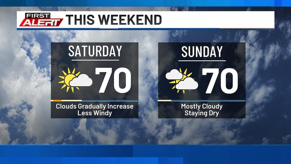
These types of conditions carry on into the weekend, with more highs in the 60s to 70s. Overnight lows will be down in the 40s. Skies will turn a bit cloudier through the day on Saturday, with mostly cloudy skies likely on Sunday. The wind picks up a bit more on Sunday, too, as our next storm system approaches.
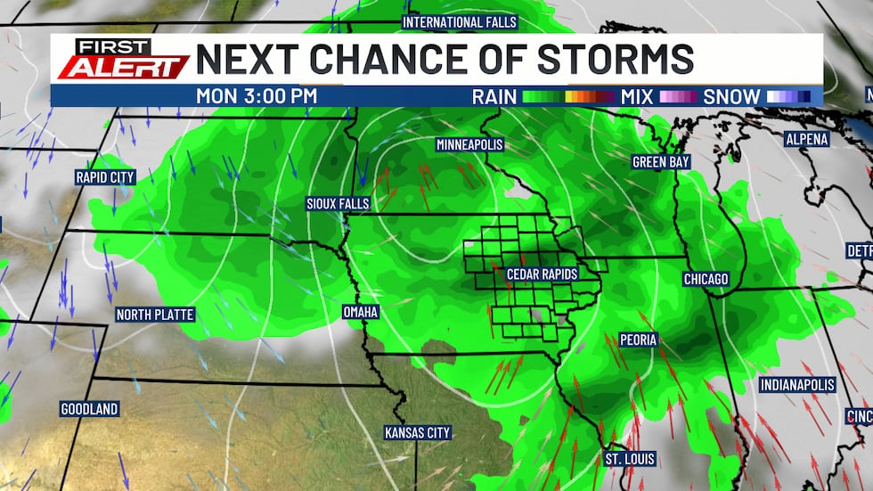
That one will bring a really good opportunity for rain and storms, starting as soon as Sunday night. This will hold off until well after dark, with activity developing on the leading edge of a push of moisture into the region.
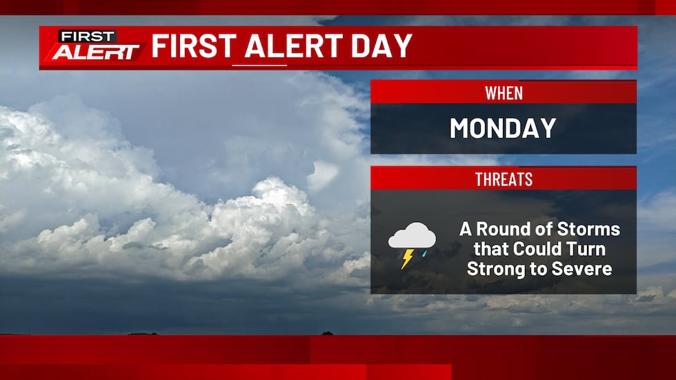
That round of activity holds into the start of Monday, but then we may catch a break. By later in the day, more shower and storm activity could develop. Because of this chance, we’ve got another first Alert Day in place for Monday.
The Storm Prediction Center has put the entire TV9 viewing area in a slight risk of severe storms on Monday due to this threat. A somewhat higher enhanced risk is off to our southeast.
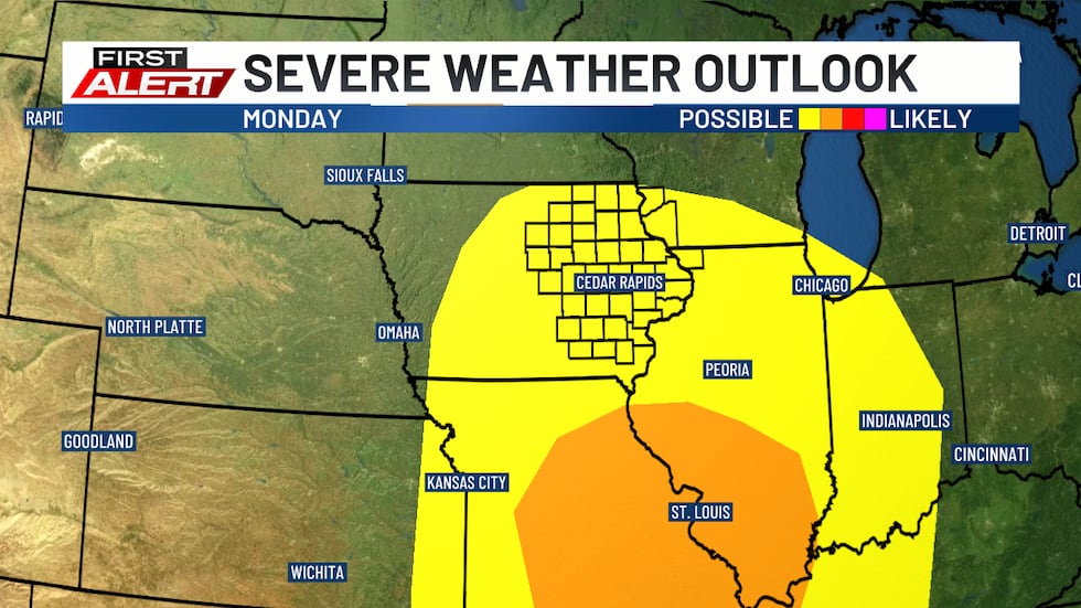
This round will be conditional, however, on the timing and track of the storm system moving through. The ability to get a break between the early-day activity and later in the day will also be a big factor. Unfortunately, these fine-scale details are often fairly murky several days out. For now, be prepared for the potential of a round of strong to severe storms in the afternoon and evening on Monday.
After this storm system moves through, we’ll catch another break from wet weather. Temperatures will be a bit cooler during this break, with lows in the 40s and highs in the low to mid 60s on Tuesday and Wednesday. Both days feature a mix of sun and clouds.
Another storm system will move near the region on Thursday and Friday next week, which could bring some more showers. Its more southerly track would also suggest cooler temperatures will stick around for a bit, with highs falling below normal for the last few days of April.
Copyright 2026 KCRG. All rights reserved.