Weather Headlines
- NEXT 9 HOURS: Storms develop this afternoon
- SHORT TERM: Strong winds & hail biggest threats
- LONG TERM: A colder weekend
Latest Forecast
CEDAR RAPIDS, Iowa (KCRG) – One more round of rocky weather is ahead before an extended period of quiet.
Strong storms will move through the forecast this afternoon.
1:00 p.m. to 8:00 p.m. time frame as the time to watch.
The Storm Prediction Center keeps most of the TV9 viewing area within its enhanced risk area (outlined in orange below).
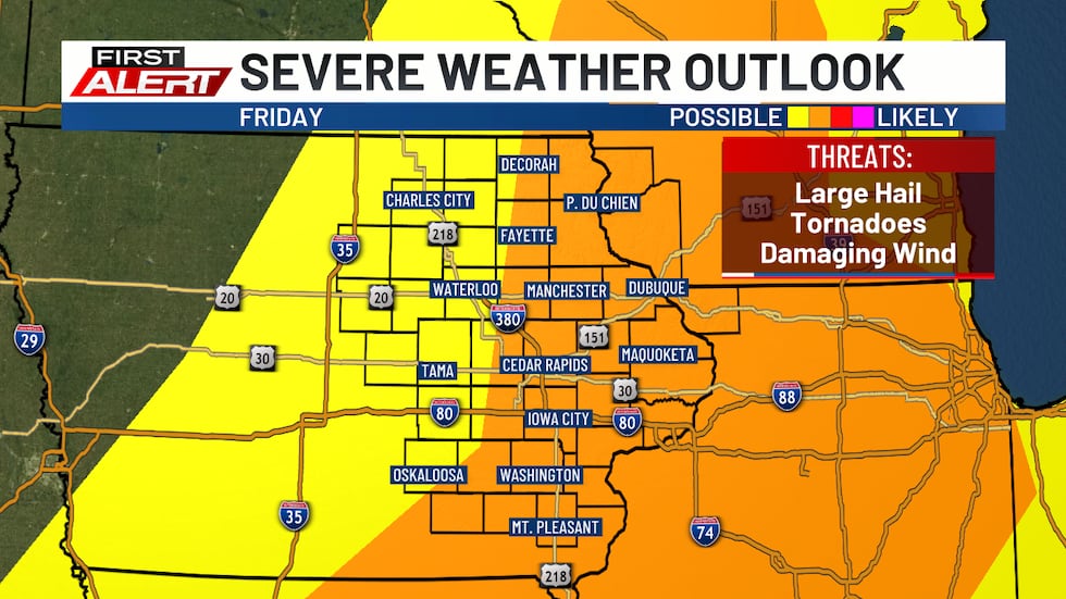
Only the far northwest corner of the northwest zone is within the slight risk (outlined in yellow).
What and When
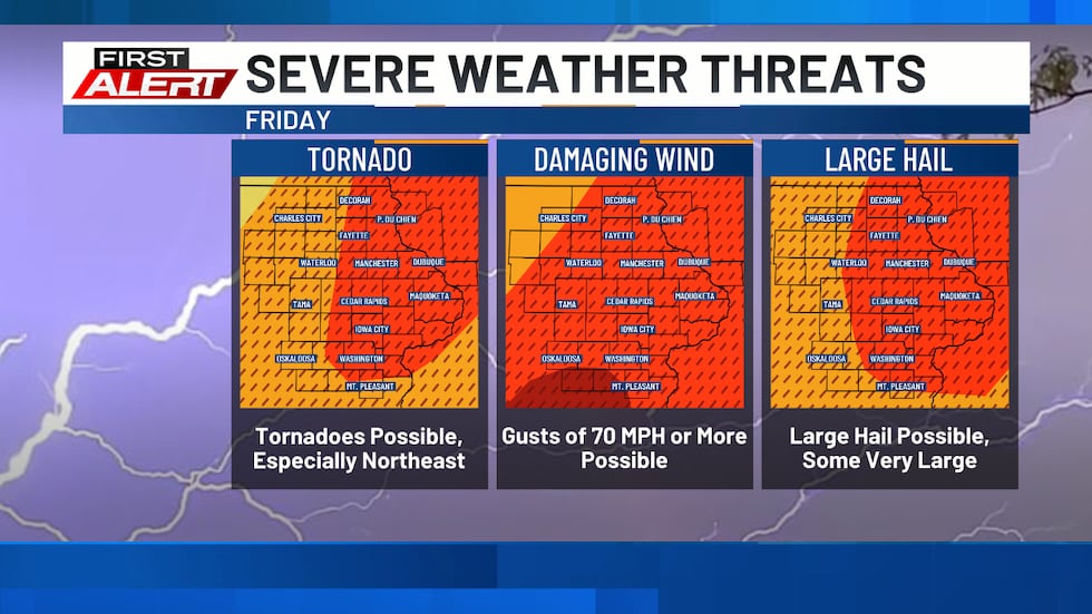
As far as the types of severe weather we could experience, all of the severe storm hazards are on the table. The risk for tornadoes is slightly higher in the northeast portion of the viewing area.
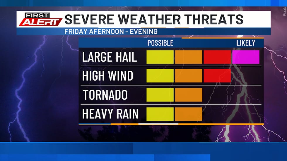
Large hail is again a risk, with some of those hailstones potentially getting to 2 inches in diameter or larger. And, damaging wind is a bigger threat than in our other storms this week, with some gusts exceeding 70 mph.
At this time, it looks like some of those isolated cells could develop early this afternoon. They would be most likely near the cold front that’s moving in, but some could also form out ahead of the front. As the cold front continues to move through eastern Iowa, it will tend to organize storms into more of a line.
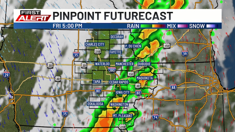
However, within that line, circulations could still lead to a few tornadoes. Storms will also be moving relatively quickly, so you’ll need to react to warnings as they’re issued.
Stay Weather-Aware
It’s important to make sure to have multiple ways to receive warnings. A NOAA Weather Radio is a great tool in this case. Make sure it’s plugged in and turned on, ready to receive warnings, before you head to bed. We also recommend the KCRG-TV9 First Alert Weather App, which can give you customized alerts for your location. Of course, we’ll also provide updates on KCRG.com and KCRG-TV9 as conditions warrant.
Weekend Outlook
Saturday will be a cool one, certainly compared to what we’ve experienced this week so far.
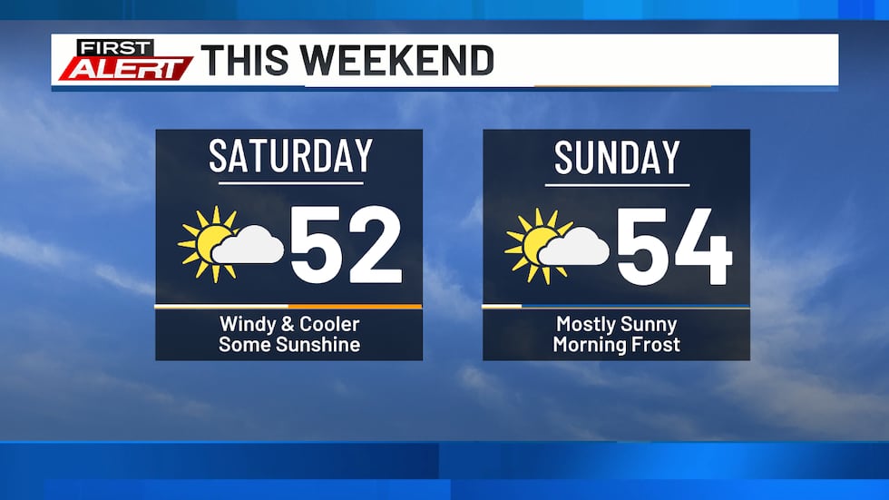
Highs will only be in the upper 40s to mid 50s. We’ll also see some stronger wind gusts during the day, with speeds potentially reaching 30 to 40 mph. It won’t be the most pleasant day in the world to be out and about, but it will be dry.
Sunday keeps the dry trend going, but it will be a rather chilly start to the day. Lows could fall into the upper 20s to low 30s. This will give us frosty or freezing conditions.
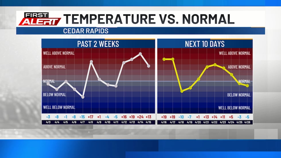
We’ll see a warming trend return for the first half of next week, pushing temperatures back above normal. We’re still going to see a cold start to the day on Monday, but highs in the afternoon hit the 60s. Widespread 70s are likely for Tuesday and Wednesday and will be accompanied by dry conditions.
Copyright 2026 KCRG. All rights reserved.