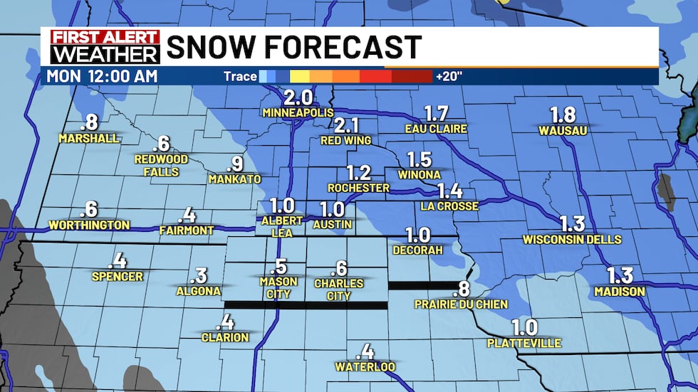
ROCHESTER, Minn. (KTTC) – Over the last 24 hours, light snow has moved through the area. About 1-2 inches fell for a lot of us.
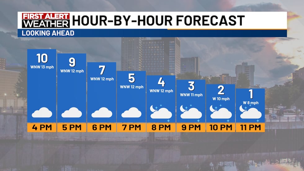
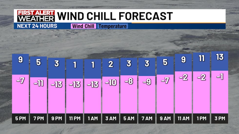
For the rest of the evening, we can expect cloudy skies and cold temperatures in the single digits. The wind will also be strong with gusts around 20-25 mph.
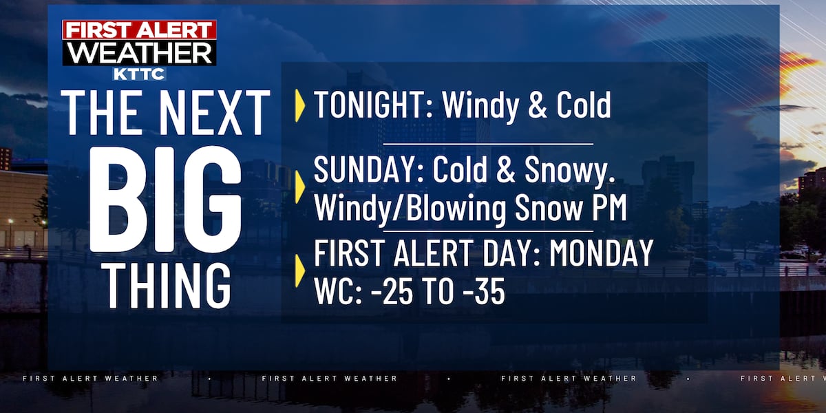
The high winds will drop our feels-like temperatures or wind chills well below zero tonight and into Sunday.
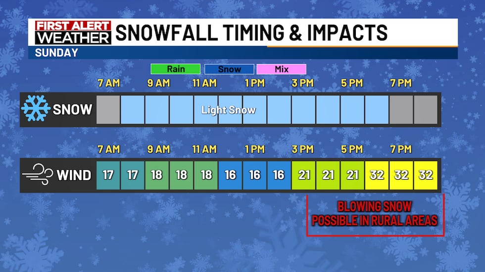
For Sunday, we will be cold & snowy with some light snow moving through the area. Our winds will really start to pick up in the late afternoon and evening, giving us blowing/drifting snow and limited visibility, especially in rural areas.
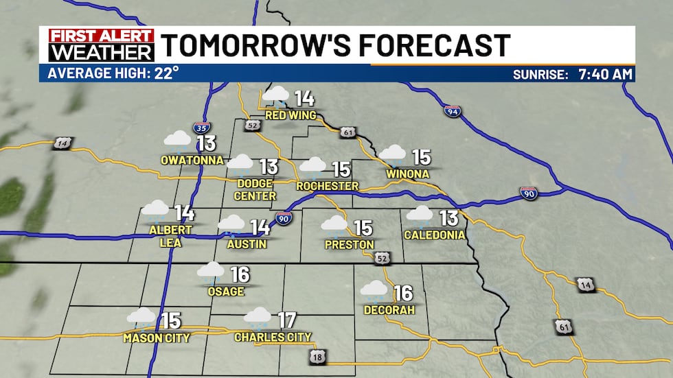
Our snow for Sunday will begin around 7/8 am. Lingering until the late afternoon/evening. The snow itself will limit some visibility, but later in the evening, when winds begin to pick up, blowing snow will be a concern, along with the very cold temperatures.
Sunday will likely be pretty similar to Friday’s snow with a quick 1-2 inches possible across most of the region. Most of north Iowa will be around the half-inch range.
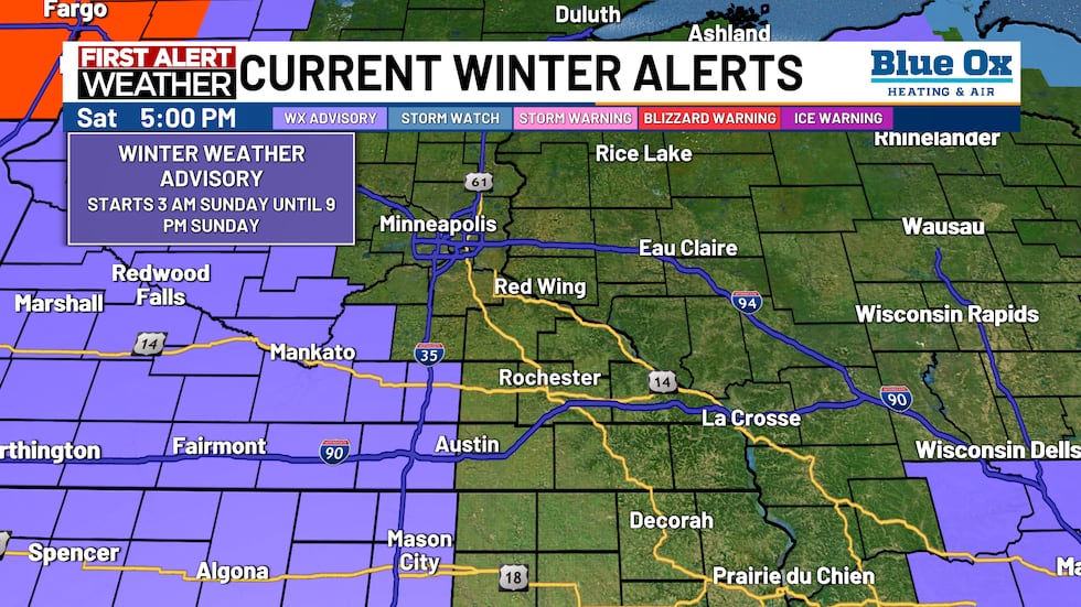
With the chance for snow on Sunday with high wind speeds, a winter weather advisory is in effect beginning at 3 am Sunday until 9 pm Sunday for the shaded counties. These counties include Steele, Freeborn, Worth, Winnebago, Hancock, and Cerro Gordo.
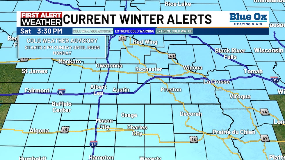
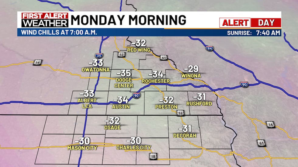
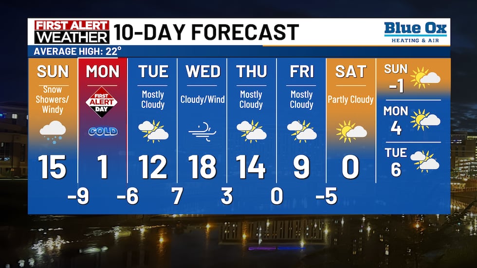
As we end the weekend, it will get very cold. As mentioned before, winds will pick up on Sunday evening. Those winds will also push in some frigid air Sunday night into Monday. A Cold Weather Advisory has been issued for the entire viewing area. This alert starts at 9 pm Sunday until noon Monday. We have also issued a First Alert Day for Monday as wind chills on Monday morning will be between -25° and -35°.
Snow showers and cold temperatures will be possible on Sunday as the cold continues into the beginning of the week. A First Alert Day has been issued for Monday due to cold temperatures.
Have a great weekend and stay warm! -Derrick
Find stories like this and more, in our apps.
Copyright 2026 KTTC. All rights reserved.